Laverlochère, Quebec
| Laverlochère | |
|---|---|
| Municipality | |
 | |
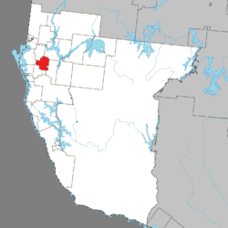 Location within Témiscamingue RCM. | |
 Laverlochère Location in western Quebec. | |
| Coordinates: 47°26′N 79°18′W / 47.433°N 79.300°WCoordinates: 47°26′N 79°18′W / 47.433°N 79.300°W[1] | |
| Country |
|
| Province |
|
| Region | Abitibi-Témiscamingue |
| RCM | Témiscamingue |
| Constituted | October 3, 1912 |
| Government[2] | |
| • Mayor | Daniel Barrette |
| • Federal riding | Abitibi—Témiscamingue |
| • Prov. riding | Rouyn-Noranda–Témiscamingue |
| Area[2][3] | |
| • Total | 106.80 km2 (41.24 sq mi) |
| • Land | 105.05 km2 (40.56 sq mi) |
| Population (2011)[3] | |
| • Total | 1,022 |
| • Density | 9.7/km2 (25/sq mi) |
| • Pop (2006–11) |
|
| • Dwellings | 430 |
| Time zone | EST (UTC−5) |
| • Summer (DST) | EDT (UTC−4) |
| Postal code(s) | J0Z 2P0 |
| Area code(s) | 819 |
| Website |
www |
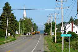
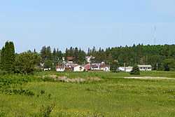
Laverlochère is a municipality in northwestern Quebec, Canada, in the Témiscamingue Regional County Municipality.
Demographics
Population trend:[4]
- Population in 2011: 1022 (2006 to 2011 population change: 39.6%)
- Population in 2006: 732
- Population in 2001: 757
- Population in 1996: 813
- Population in 1991: 854
Private dwellings occupied by usual residents: 402 (total dwellings: 430)
Mother tongue:[5]
- English as first language: 1.4%
- French as first language: 98.6%
- English and French as first language: 0%
- Other as first language: 0%
See also
References
- ↑ Reference number 370498 of the Commission de toponymie du Québec (French)
- ↑ 2.0 2.1 "Laverlochère". Répertoire des municipalités (in French). Ministère des Affaires municipales, des Régions et de l'Occupation du territoire. Retrieved 2010-12-31.
- ↑ 3.0 3.1 "Laverlochère census profile". 2011 Census data. Statistics Canada. Retrieved 2010-12-31.
- ↑ Statistics Canada: 1996, 2001, 2006, 2011 census
- ↑ "Laverlochère community profile". 2006 Census data. Statistics Canada. Retrieved 2010-12-31.
 |
Saint-Eugène-de-Guigues, Angliers | | ||
| Saint-Bruno-de-Guigues | |
Fugèreville | ||
| ||||
| | ||||
| Lorrainville |
| ||||||||||||||||||||||||||||||