Lavelanet
| Lavelanet | ||
|---|---|---|
|
The church in Lavelanet | ||
| ||
 Lavelanet | ||
|
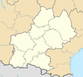
Location within Midi-Pyrénées region  Lavelanet | ||
| Coordinates: 42°56′01″N 1°50′58″E / 42.9336°N 1.8494°ECoordinates: 42°56′01″N 1°50′58″E / 42.9336°N 1.8494°E | ||
| Country | France | |
| Region | Midi-Pyrénées | |
| Department | Ariège | |
| Arrondissement | Foix | |
| Canton | Lavelanet | |
| Intercommunality | Pays d'Olmes | |
| Government | ||
| • Mayor (2008–2014) | Marc Sanchez | |
| Area1 | 12.57 km2 (4.85 sq mi) | |
| Population (2008)2 | 6,747 | |
| • Density | 540/km2 (1,400/sq mi) | |
| INSEE/Postal code | 09160 / 09300 | |
| Elevation |
490–802 m (1,608–2,631 ft) (avg. 525 m or 1,722 ft) | |
|
1 French Land Register data, which excludes lakes, ponds, glaciers > 1 km² (0.386 sq mi or 247 acres) and river estuaries. 2 Population without double counting: residents of multiple communes (e.g., students and military personnel) only counted once. | ||
Lavelanet (L'Avelhanet in the Languedocian dialect of Occitan) is a commune in the Ariège department in the Midi-Pyrénées region in southwestern France.
Population
| Historical population | ||
|---|---|---|
| Year | Pop. | ±% |
| 1793 | 1,191 | — |
| 1800 | 1,222 | +2.6% |
| 1806 | 1,508 | +23.4% |
| 1821 | 1,717 | +13.9% |
| 1831 | 1,852 | +7.9% |
| 1836 | 2,527 | +36.4% |
| 1841 | 2,898 | +14.7% |
| 1846 | 3,004 | +3.7% |
| 1851 | 3,062 | +1.9% |
| 1856 | 2,944 | −3.9% |
| 1861 | 3,006 | +2.1% |
| 1866 | 3,033 | +0.9% |
| 1872 | 3,292 | +8.5% |
| 1876 | 3,095 | −6.0% |
| 1881 | 3,205 | +3.6% |
| 1886 | 3,246 | +1.3% |
| 1891 | 2,981 | −8.2% |
| 1896 | 3,179 | +6.6% |
| 1901 | 2,196 | −30.9% |
| 1906 | 3,270 | +48.9% |
| 1911 | 3,532 | +8.0% |
| 1921 | 3,608 | +2.2% |
| 1926 | 4,827 | +33.8% |
| 1931 | 4,849 | +0.5% |
| 1936 | 4,933 | +1.7% |
| 1946 | 5,541 | +12.3% |
| 1954 | 6,820 | +23.1% |
| 1962 | 7,648 | +12.1% |
| 1968 | 8,630 | +12.8% |
| 1975 | 9,346 | +8.3% |
| 1982 | 8,368 | −10.5% |
| 1990 | 7,740 | −7.5% |
| 1999 | 6,872 | −11.2% |
| 2008 | 6,747 | −1.8% |
Its inhabitants are called Lavelanetiens.
Place d'Europe
Tour de France
In 2002 the 13th stage of the Tour de France started in Lavelanet.[1]
In 2008 the 12th stage of the Tour de France started in Lavelanet.
Etymology
The name of Lavelanet comes from the Latin avellana meaning "hazel nut" (noisette in French).
Personalities
- Fabien Barthez, footballer
- Benoît Baby, rugby player
- Jean-Paul Banos, fencer
- Perrine Laffont, mogul skier
See also
References
| Wikimedia Commons has media related to Lavelanet. |
.svg.png)