Lauta
This article is about the town in the district of Bautzen, Saxony. For the village in the town of Marienberg, Saxony, see Lauta (Marienberg).
| Lauta | ||
|---|---|---|
| ||
 Lauta | ||
Location of Lauta within Bautzen district 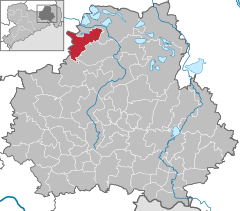
 | ||
| Coordinates: 51°26′53″N 14°5′59″E / 51.44806°N 14.09972°ECoordinates: 51°26′53″N 14°5′59″E / 51.44806°N 14.09972°E | ||
| Country | Germany | |
| State | Saxony | |
| District | Bautzen | |
| Government | ||
| • Mayor | Hellfried Ruhland | |
| Area | ||
| • Total | 41.87 km2 (16.17 sq mi) | |
| Population (2013-12-31)[1] | ||
| • Total | 8,838 | |
| • Density | 210/km2 (550/sq mi) | |
| Time zone | CET/CEST (UTC+1/+2) | |
| Postal codes | 02991 | |
| Dialling codes | 035722 | |
| Vehicle registration | BZ | |
| Website | www.lauta.de | |

Lauta (Sorbian: Łuty) is a town in the district of Bautzen, in the Free State of Saxony, Germany. It is situated 10 km west of Hoyerswerda, and 10 km southeast of Senftenberg.
-
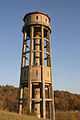
Watertower
-
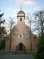
Catholic church
-
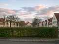
Housing complex
-
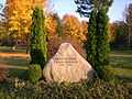
Monument in Laubusch, district of Lauta
References
- ↑ "Statistisches Landesamt des Freistaates Sachsen – Bevölkerung des Freistaates Sachsen jeweils am Monatsende ausgewählter Berichtsmonate nach Gemeinden" (PDF). Statistisches Landesamt des Freistaates Sachsen (in German). 6 September 2014.