Latrobe Council
| Latrobe Council | |||||||||||||
|---|---|---|---|---|---|---|---|---|---|---|---|---|---|
|
Latrobe Council | |||||||||||||
| Coordinates | 41°13′48″S 146°31′12″E / 41.23000°S 146.52000°ECoordinates: 41°13′48″S 146°31′12″E / 41.23000°S 146.52000°E | ||||||||||||
| Population | 10,020 (2010 est.)[1] | ||||||||||||
| • Density | 18.22/km2 (47.2/sq mi) | ||||||||||||
| Area | 550 km2 (212.4 sq mi) | ||||||||||||
| Mayor | Michael Gaffney | ||||||||||||
| Council seat | Latrobe | ||||||||||||
| Region | North West Tasmania | ||||||||||||
| State electorate(s) | Braddon | ||||||||||||
| Federal Division(s) | Braddon | ||||||||||||
| Website | Latrobe Council | ||||||||||||
| |||||||||||||
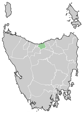
The Latrobe Council is a local government area in the north-western region of Tasmania. It covers the town of Latrobe and surrounding regions, including the coastal towns of Shearwater and Port Sorell.
It is subdivided into the townships of Latrobe, Port Sorell, Shearwater, Hawley Beach, Wesley Vale, Sassafras, Moriarty and Tarleton.
References
- ↑ "3218.0 - Regional Population Growth, Australia, 2009-10". Australian Bureau of Statistics. 31 March 2011. Retrieved 23 August 2011. Estimated resident population (ERP) at 30 June 2010.