Largo, Maryland
| Largo, Maryland | |
|---|---|
| Census-designated place | |
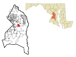 Location of Largo, Maryland | |
| Coordinates: 38°52′37″N 76°49′50″W / 38.87694°N 76.83056°WCoordinates: 38°52′37″N 76°49′50″W / 38.87694°N 76.83056°W | |
| Country |
|
| State |
|
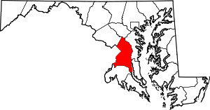
| County |
|
| Area | |
| • Total | 3.0 sq mi (7.9 km2) |
| • Land | 3.0 sq mi (7.9 km2) |
| • Water | 0.0 sq mi (0.0 km2) |
| Elevation | 174 ft (53 m) |
| Population (2010) | |
| • Total | 10,709 |
| • Density | 3,600/sq mi (1,400/km2) |
| Time zone | Eastern (EST) (UTC-5) |
| • Summer (DST) | EDT (UTC-4) |
| ZIP code | 20774 |
| Area code(s) | 301 |
| FIPS code | 24-45825 |
| GNIS feature ID | 0597664 |
Largo is an unincorporated area and census-designated place in Prince George's County, Maryland, in the United States.[1] The population was 10,709 at the 2010 census.[2]
Largo is located just east of the Capital Beltway (I-95/495) and is home to Prince George's Community College and Largo High School. Six Flags America amusement park (formerly known as Wild World and Adventure World) is to the east in Mitchellville, and FedExField, the Washington Redskins' football stadium, is across the Capital Beltway in Summerfield. Watkins Regional Park in Kettering just to the east of Largo (operated by the Maryland-National Capital Park and Planning Commission) has an old-fashioned carousel, miniature train ride, miniature golf, the Old Maryland Farm, a very large playground, and animals on display.[3] Largo is not a post office designation, but is at the northern end of the Greater Upper Marlboro ZIP code area.
Since the transit system's expansion in late 2004, Largo Town Center has served as the eastern end of the Blue Line of the Washington Metro.
Geography
Largo is located at 38°52′37″N 76°49′50″W / 38.87694°N 76.83056°W (38.876850, -76.830651).[4]
According to the United States Census Bureau, the CDP has a total area of 3.0 square miles (7.8 km2), all of it land.
Demographics
| Historical population | |||
|---|---|---|---|
| Census | Pop. | %± | |
| 1980 | 5,557 | — | |
| 1990 | 9,475 | 70.5% | |
| 2000 | 8,408 | −11.3% | |
| 2010 | 10,709 | 27.4% | |
| source:[2][5] | |||
As of the census[6] of 2000, there were 8,408 people, 3,471 households, and 2,127 families residing in the CDP. The population density was 2,758.8 people per square mile (1,064.4/km²). There were 3,709 housing units at an average density of 1,217.0/sq mi (469.5/km²). The racial makeup of the CDP was 4.27% White, 92.69% African American, 0.13% Native American, 0.78% Asian, 0.04% Pacific Islander, 0.51% from other races, and 1.58% from two or more races. Hispanic or Latino of any race were 1.43% of the population.
There were 3,471 households out of which 31.7% had children under the age of 18 living with them, 34.3% were married couples living together, 22.4% had a female householder with no husband present, and 38.7% were non-families. 31.9% of all households were made up of individuals and 3.3% had someone living alone who was 65 years of age or older. The average household size was 2.41 and the average family size was 3.09.
In the CDP the population was spread out with 25.3% under the age of 18, 8.4% from 18 to 24, 35.9% from 25 to 44, 25.7% from 45 to 64, and 4.7% who were 65 years of age or older. The median age was 34 years. For every 100 females there were 79.4 males. For every 100 females age 18 and over, there were 73.7 males.
The median income for a household in the CDP was $58,130, and the median income for a family was $70,421. Males had a median income of $40,067 versus $37,417 for females. The per capita income for the CDP was $26,312. About 3.2% of families and 5.3% of the population were below the poverty line, including 7.6% of those under age 18 and 6.5% of those age 65 or over.
Education
Largo is a part of the Prince George's County Public Schools.
High Road Upper School, Largo MD
Largo High School serves the community.
The community is also home to Prince George's Community College, serving a county population of 850,000 residents.
Notable people
- Wale Folarin, Rapper
- Oddisee, Rapper
- Albert Wynn, former Congressman.[7]
References
| Wikivoyage has a travel guide for Largo (Maryland). |
- ↑ U.S. Geological Survey Geographic Names Information System: Largo, Maryland
- ↑ 2.0 2.1 "Profile of General Population and Housing Characteristics: 2010 Demographic Profile Data (DP-1): Largo CDP, Maryland". U.S. Census Bureau, American Factfinder. Retrieved December 22, 2011.
- ↑ http://www.pgparks.com/page342.aspx
- ↑ "US Gazetteer files: 2010, 2000, and 1990". United States Census Bureau. 2011-02-12. Retrieved 2011-04-23.
- ↑ "CENSUS OF POPULATION AND HOUSING (1790-2000)". U.S. Census Bureau. Retrieved 2010-07-18.
- ↑ "American FactFinder". United States Census Bureau. Retrieved 2008-01-31.
- ↑ Barone, Michael; Ujifusa, Grant (1999). The Almanac of American Politics 2000. National Journal Group Inc. p. 753.