Lardon Chase, the Holies and Lough Down


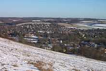
Lardon Chase, the Holies and Lough Down are three adjacent National Trust countryside properties in the English county of Berkshire. They are situated on the edge of the Berkshire Downs above the village of Streatley and overlooking the Goring Gap. Together they comprise an outstanding area of 27 hectares (67 acres) of downland and woodland with many attractive walks and views. The properties adjoin the Goring and Streatley Golf Club.[1]
Lardon Chase, and a part of the Holies known as Holies Down, are also designated as Sites of Special Scientific Interest. The properties lie within the North Wessex Downs Area of Outstanding Natural Beauty.[2][3]
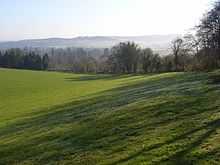
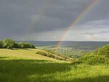
Lardon Chase and Lough Down comprise a spur of downland which lies to the west of Goring and Streatley. The slopes form one of the largest remaining areas of chalk grassland in the county and support a wide range of flowers and butterflies. The area has a long history of ancient settlements and there are several Neolithic and Iron Age forts. It is crossed by The Ridgeway and other ancient routes used by the Romans.[1]
The Holies is a grassy coombe which is separated from Lardon Chase and Lough Down by the B4009 road from Streatley to Newbury. Before acquisition by the National Trust, the Holies was used for motorbike scrambling and turf stripping, resulting in considerable damage to the ground. Now the natural recolonisation of the bare land by chalk-loving plant species is being carefully nurtured and monitored.[1]
All three properties are accessible from a car park located on the B4009, or by steeply climbing footpaths from Streatley village. Access is free, and available at all times.
References
- ↑ 1.0 1.1 1.2 "Thames & Solent - Places to Visit - Countryside". National Trust. Retrieved 2007-11-04.
- ↑ "SSSI Information - Lardon Chase". Natural England. Retrieved 2007-11-05.
- ↑ "SSSI Information - Holies Down". Natural England. Retrieved 2007-11-05.
External links
 Media related to Lardon Chase, the Holies and Lough Down at Wikimedia Commons
- Thames and Solent countryside page at the National Trust
- Map sources for Lardon Chase, the Holies and Lough Down