Lannilis
| Lannilis Lanniliz | ||
|---|---|---|
|
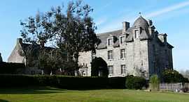
The Chateau of Kerouartz | ||
| ||
 Lannilis | ||
|
Location within Brittany region  Lannilis | ||
| Coordinates: 48°34′15″N 4°31′08″W / 48.5708°N 4.5189°WCoordinates: 48°34′15″N 4°31′08″W / 48.5708°N 4.5189°W | ||
| Country | France | |
| Region | Brittany | |
| Department | Finistère | |
| Arrondissement | Brest | |
| Canton | Lannilis | |
| Intercommunality | Plabennec et des Abers | |
| Government | ||
| • Mayor (2014–2020) | Jean-François Tréguer | |
| Area1 | 23.52 km2 (9.08 sq mi) | |
| Population (2008)2 | 5,084 | |
| • Density | 220/km2 (560/sq mi) | |
| INSEE/Postal code | 29117 / 29870 | |
| Elevation | 0–58 m (0–190 ft) | |
|
1 French Land Register data, which excludes lakes, ponds, glaciers > 1 km² (0.386 sq mi or 247 acres) and river estuaries. 2 Population without double counting: residents of multiple communes (e.g., students and military personnel) only counted once. | ||
Lannilis (Breton: Lanniliz) is a commune in the Finistère department of Brittany in north-western France.
Population
Inhabitants of Lannilis are called in French Lannilisiens.
| Historical population | ||
|---|---|---|
| Year | Pop. | ±% |
| 1793 | 2,471 | — |
| 1800 | 3,112 | +25.9% |
| 1806 | 3,315 | +6.5% |
| 1821 | 2,866 | −13.5% |
| 1831 | 3,179 | +10.9% |
| 1836 | 3,094 | −2.7% |
| 1841 | 3,124 | +1.0% |
| 1846 | 3,361 | +7.6% |
| 1851 | 3,430 | +2.1% |
| 1856 | 3,386 | −1.3% |
| 1861 | 3,326 | −1.8% |
| 1866 | 3,318 | −0.2% |
| 1872 | 3,318 | +0.0% |
| 1876 | 3,270 | −1.4% |
| 1881 | 3,225 | −1.4% |
| 1886 | 3,231 | +0.2% |
| 1891 | 3,323 | +2.8% |
| 1896 | 3,363 | +1.2% |
| 1901 | 3,406 | +1.3% |
| 1906 | 3,553 | +4.3% |
| 1911 | 3,591 | +1.1% |
| 1921 | 3,312 | −7.8% |
| 1926 | 3,527 | +6.5% |
| 1931 | 3,550 | +0.7% |
| 1936 | 3,430 | −3.4% |
| 1946 | 3,750 | +9.3% |
| 1954 | 3,432 | −8.5% |
| 1962 | 3,612 | +5.2% |
| 1968 | 3,556 | −1.6% |
| 1975 | 3,686 | +3.7% |
| 1982 | 3,939 | +6.9% |
| 1990 | 4,272 | +8.5% |
| 1999 | 4,475 | +4.8% |
| 2008 | 5,086 | +13.7% |
Breton language
The municipality launched a linguistic plan through Ya d'ar brezhoneg on 27 June 2008.
In 2008, 33.17% of primary-school children attended bilingual schools.[1]
See also
References
- ↑ (French) Ofis ar Brezhoneg: Enseignement bilingue
- Mayors of Finistère Association (French);
External links
| Wikimedia Commons has media related to Lannilis. |

