Langogne
| Langogne | ||
|---|---|---|
|
A view of the river flowing through Langogne | ||
| ||
 Langogne | ||
|
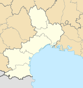
Location within Languedoc-Roussillon region  Langogne | ||
| Coordinates: 44°43′40″N 3°51′21″E / 44.7278°N 3.8558°ECoordinates: 44°43′40″N 3°51′21″E / 44.7278°N 3.8558°E | ||
| Country | France | |
| Region | Languedoc-Roussillon | |
| Department | Lozère | |
| Arrondissement | Mende | |
| Canton | Langogne | |
| Government | ||
| • Mayor (2005–2008) | Magdeleine Romeuf | |
| Area1 | 31.37 km2 (12.11 sq mi) | |
| Population (1999)2 | 3,095 | |
| • Density | 99/km2 (260/sq mi) | |
| INSEE/Postal code | 48080 / 48300 | |
| Elevation |
886–1,097 m (2,907–3,599 ft) (avg. 913 m or 2,995 ft) | |
|
1 French Land Register data, which excludes lakes, ponds, glaciers > 1 km² (0.386 sq mi or 247 acres) and river estuaries. 2 Population without double counting: residents of multiple communes (e.g., students and military personnel) only counted once. | ||
Langogne is a commune in the Lozère department in southern France.
See also
External links
- Langogne in Lozere (separate texts in French and English; photographs)
- Regordane Info - The independent portal for The Regordane Way or St Gilles Trail, which passes through Langogne. (in English and French)
| Wikimedia Commons has media related to Langogne. |
