Langley, Virginia
This article is about the unincorporated community of Langley in McLean, Virginia. For the military installation in Hampton, Virginia, see Joint Base Langley–Eustis.
| Langley | |
|---|---|
| Unincorporated community | |
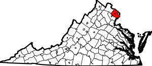
 Langley Location within the state of Virginia | |
| Coordinates: 38°56′47″N 77°9′32″W / 38.94639°N 77.15889°WCoordinates: 38°56′47″N 77°9′32″W / 38.94639°N 77.15889°W | |
| Country | United States |
| State | Virginia |
| County | Fairfax |
| Time zone | Eastern (EST) (UTC-5) |
| • Summer (DST) | EDT (UTC-4) |
| ZIP codes | 22101, 22102 |
| GNIS feature ID | 1495816[1] |

Langley High School, pictured here in June 2008, serves much of northeastern Fairfax County, Virginia. Visible on the left is the five stone memorial to the families affected by the September 11 attack on the Pentagon.
Langley is an unincorporated community in the census-designated place of McLean in Fairfax County, Virginia, United States. Langley is often used as a metonym for the CIA.
The community was essentially absorbed into McLean many years ago, although there is still a Langley High School.[2] In addition to being a bedroom community for Washington, D.C., the area is the site of the headquarters for the Central Intelligence Agency (CIA), the Turner-Fairbank Highway Research Center of the Federal Highway Administration, and the Claude Moore Colonial Farm of the National Park Service.
See also
References
- ↑ U.S. Geological Survey Geographic Names Information System: Langley, Virginia
- ↑ "Langley HS Map" (PDF). Fairfax County Public Schools. 2008. Retrieved 2008-10-06.
| |||||||||||||||||||||
