Lane Township, Warrick County, Indiana
| Lane Township Warrick County | |
|---|---|
| Township | |
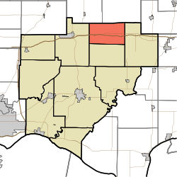 Location in Warrick County | |
| Coordinates: 38°12′19″N 87°10′55″W / 38.20528°N 87.18194°WCoordinates: 38°12′19″N 87°10′55″W / 38.20528°N 87.18194°W | |
| Country | United States |
| State | Indiana |
| County | Warrick |
| Government | |
| • Type | Indiana township |
| Area | |
| • Total | 23.95 sq mi (62.0 km2) |
| • Land | 23.51 sq mi (60.9 km2) |
| • Water | 0.43 sq mi (1.1 km2) 1.80% |
| Elevation | 449 ft (137 m) |
| Population (2010) | |
| • Total | 281 |
| • Density | 12/sq mi (5/km2) |
| ZIP codes | 47523, 47601, 47619, 47637 |
| GNIS feature ID | 0453541 |
Lane Township is one of ten townships in Warrick County, Indiana, United States. As of the 2010 census, its population was 281 and it contained 119 housing units.[1]
Geography
According to the 2010 census, the township has a total area of 23.95 square miles (62.0 km2), of which 23.51 square miles (60.9 km2) (or 98.16%) is land and 0.43 square miles (1.1 km2) (or 1.80%) is water.[1]
History
Lane Township was formed out of Owen Township in December 1859.
Unincorporated towns
- Hemenway at 38°12′14″N 87°08′04″W / 38.20394°N 87.134447°W
- Jockey at 38°10′42″N 87°09′48″W / 38.178383°N 87.163336°W
- Scalesville at 38°12′09″N 87°12′22″W / 38.20255°N 87.206116°W
(This list is based on USGS data and may include former settlements.)
Adjacent townships
- Lockhart Township, Pike County (northeast)
- Pigeon Township (east)
- Owen Township (south)
- Hart Township (west)
- Monroe Township, Pike County (northwest)
Cemeteries
The township contains these two cemeteries: Ashby and Ebenezer.
School districts
- Warrick County School Corporation
Political districts
- Indiana's 8th congressional district
- State House District 74
- State Senate District 47
References
- United States Census Bureau 2007 TIGER/Line Shapefiles
- United States Board on Geographic Names (GNIS)
- IndianaMap
- ↑ 1.0 1.1 "Population, Housing Units, Area, and Density: 2010 - County -- County Subdivision and Place -- 2010 Census Summary File 1". United States Census. Retrieved 2013-05-10.
External links
| |||||||||||||||||||||||||