Landes-le-Gaulois
| Landes-le-Gaulois | |
|---|---|
|
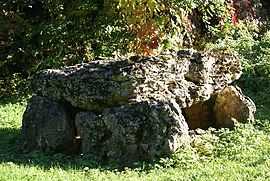
One of the Dolmens in Landes-le-Gaulois | |
 Landes-le-Gaulois | |
|
Location within Centre region  Landes-le-Gaulois | |
| Coordinates: 47°39′12″N 1°11′02″E / 47.6533°N 1.1839°ECoordinates: 47°39′12″N 1°11′02″E / 47.6533°N 1.1839°E | |
| Country | France |
| Region | Centre-Val de Loire |
| Department | Loir-et-Cher |
| Arrondissement | Blois |
| Canton | Herbault |
| Intercommunality | Communauté de communes Beauce - Val de Cisse |
| Government | |
| • Mayor (2008–2014) | Didier Guillon |
| Area1 | 24.15 km2 (9.32 sq mi) |
| Population (1999)2 | 582 |
| • Density | 24/km2 (62/sq mi) |
| INSEE/Postal code | 41109 / 41190 |
| Elevation |
97–128 m (318–420 ft) (avg. 105 m or 344 ft) |
|
1 French Land Register data, which excludes lakes, ponds, glaciers > 1 km² (0.386 sq mi or 247 acres) and river estuaries. 2 Population without double counting: residents of multiple communes (e.g., students and military personnel) only counted once. | |
Landes-le-Gaulois is a commune in the Loir-et-Cher department of central France.
See also
| Wikimedia Commons has media related to Landes-le-Gaulois. |