Lamine Township, Cooper County, Missouri
| Lamine Township | |
|---|---|
| Township | |
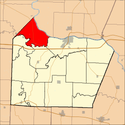 Location in Cooper County | |
| Coordinates: 38°59′19″N 92°56′32″W / 38.98861°N 92.94222°WCoordinates: 38°59′19″N 92°56′32″W / 38.98861°N 92.94222°W | |
| Country |
|
| State |
|
| County | Cooper |
| Area | |
| • Total | 40.86 sq mi (105.83 km2) |
| • Land | 39.5 sq mi (102.31 km2) |
| • Water | 1.36 sq mi (3.52 km2) 3.33% |
| Elevation | 755 ft (230 m) |
| Population (2000) | |
| • Total | 289 |
| • Density | 7.3/sq mi (2.8/km2) |
| Time zone | CST (UTC-6) |
| • Summer (DST) | CDT (UTC-5) |
| ZIP code | 65322 |
| GNIS feature ID | 0766531 |
Lamine Township is one of 14 townships in Cooper County, in the U.S. state of Missouri. As of the 2000 census, its population was 289.[1]
Geography
According to the United States Census Bureau, Lamine Township covers an area of 40.86 square miles (105.83 square kilometers); of this, 39.5 square miles (102.31 square kilometers, 96.67 percent) is land and 1.36 square miles (3.52 square kilometers, 3.33 percent) is water.
Unincorporated towns
Adjacent townships
- Boonslick Township, Howard County (northeast)
- Boonville Township (east)
- Pilot Grove Township (south)
- Blackwater Township (southwest)
- Blackwater Township, Saline County (west)
- Arrow Rock Township, Saline County (northwest)
Cemeteries
The township contains these two cemeteries: Herndon and Hoke.
Major highways
Lakes
- Widel Lake
Landmarks
- Arrow Rock State Park
School districts
- Pilot Grove C-4
Political districts
- Missouri's 6th congressional district
- State House District 117
- State Senate District 21
References
- United States Census Bureau 2008 TIGER/Line Shapefiles
- United States Board on Geographic Names (GNIS)
- United States National Atlas
External links
 |
Arrow Rock Township, Saline County | |
Boonslick Township, Howard County | |
| Blackwater Township, Saline County | |
Boonville Township | ||
| ||||
| | ||||
| Blackwater Township | Pilot Grove Township |
| |||||||||||||||||||||||||
