Lakkidi, Wayanad
Lakkidi is the gateway of Wayanad district of Kerala state, south India. It gets the second highest degree of rainfall in the world. Lakkidi is one of the highest locations in Wayanad. It is situated 700 m above mean sea level, atop Thamarassery ghat pass. Vythiri is the nearest town, just 5 km from Lakkidi.[1] Chain tree, Pookot Lake, Sight seeing point on ghat road and number of tourist resorts are within 5 km from Lakkidi. It is about 58 km northeast of Kozhikode district
The lofty mountain peaks, the gurgling stream, luxuriant vegetation and the bird's eye view of the deep valley on the south, with its winding roads, are breathtaking. Three km from Lakkidi is the Pookot Lake, the natural fresh water lake, very wide and deep, one of the rare reservoirs of water in Wayanad. Surrounded on all sides by meadows and hills, it has become a favorite picnic spot. Lakkidi has a heavy rainfall with averaging 600–650 cm annually.Iit is one of the richest biodiversity areas in the western Ghats. There are a number of species including lion tailed macque, rare birds, Indian Shag (phalacrocorase fuscicollis), Little Cormorant (Phalacrocorax Niger), Little Green Heron (Ardeola striatus ), and Pond Heron (Ardeola grayii) .
History
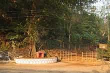
Once during the colonial rule, Lakkidi was a secret route for local adivasis of Wayanad. Later the British identified the route and asked an adivasi how he could export things such as pepper, spices, etc. The tribal or adivasi helped him to find the route way out. Once the British found out the way they killed the adiviasi. Later it was seen that the travellers who passed by the routes had not reached their destination. Hence a priest was called and in a chain his spirit was called, and tied in a small tree. Then it started growing along with the tree. Every year there will be a festtival also known as utsavam in Malayalam with the feast along the roadside of temple.
Climate
Lakkidi is a true rainforest along some deciduous forests in the Ghats section of Wayanad so rains starts in May and ends in December, due to the rainfall and beauty it is often called "chirapunjee of Kerala". It has an average rainfall ranging from 600–650 cm or above. It experiences chilly climate throughout the year with mist and fog. It is said to be coldest place in Wayanad district as well as one of coldest in Kerala. it enjoys koppen highland climate. Generally monsoons come with torrential rainfall and windy weather .
| jan | feb | mar | apr | may | jun | jul | aug | sep | oct | nov | dec | |
|---|---|---|---|---|---|---|---|---|---|---|---|---|
| 17 | 20 | 21 | 22 | 25 | 23 | 21 | 20 | 20 | 19 | 18 | 18 | |
| 6 | 10 | 13 | 15 | 17 | 16 | 15 | 14 | 12 | 11 | 10 | 8 | |
the given above are average high and low, lakkidi experiences warm climate from [march - may] and cold climate from [oct - jan]
Lakkidi has highly rich soil with an average height of 700 m above sea level thus forming one of highest mountains in Wayanad district. Good soil has resulted in plants like coffee, tea, oranges, spices, etc. It gets copious rainfall latire soil.
Transportation
From Kozhikode: Thamarassery–Lakkidi Ghat road, part of NH 212, which connects Kozhikkode and the rest of Kerala, south of Kozhikkode with Wayanad.
References
| Wikimedia Commons has media related to Lakkidi, Wayanad. |