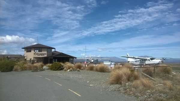
Lake Tekapo Airport
| Lake Tekapo Airport | |||||||||||
|---|---|---|---|---|---|---|---|---|---|---|---|
| IATA: none – ICAO: NZTL | |||||||||||
| Summary | |||||||||||
| Airport type | Private | ||||||||||
| Operator | Air Safaris Ltd | ||||||||||
| Serves | Lake Tekapo (town) | ||||||||||
| Elevation AMSL | 2,496 ft / 760 m | ||||||||||
| Coordinates | S 44 00 18 E 170 26 30* | ||||||||||
| Runways | |||||||||||
| |||||||||||
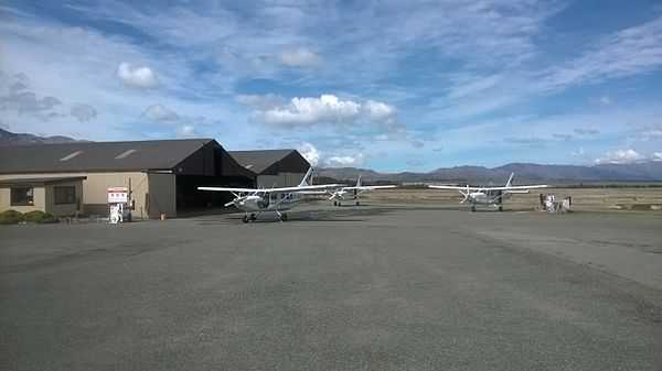
Lake Tekapo Airport (IATA: N/A, ICAO: NZTL) is a Non-Certificated Airport 1.5 NM (2.8 km; 1.7 mi) west of Lake Tekapo township in the Mackenzie District of the South Island in New Zealand. The airport was constructed by Air Safaris in 1974 for scenic charter flights over the Southern Alps.
Operational information
Movements restricted to paved areas.
Non-standard RWY markings for Air Safaris reference and use only.
CAUTION: Main highway on approach to RWY 11. Maintain adequate clearance.
CAUTION: Tekapo/Mackenzie heliport located 1.5NM to SW of aerodrome.
VFR operations within NZB978 Southern Alps MBZ are subject to special procedures.
Refer to ENR 1.16 VFR Procedures, Mount Cook/Westland.
LED emergency lighting available — full length. VFR night operations limited to Air Safaris
approved pilots.
Fuel: Greenstone Energy Swipecard AVGAS, Jet A1
Gallery


Sources
- NZAIP Volume 4 AD
- AIP New Zealand (PDF)