Lake Saint Pierre
| Lake Saint Pierre (Lac Saint-Pierre) | |
|---|---|
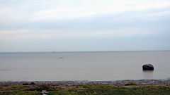 View on the lake from Pointe-du-Lac (a sector of Trois-Rivières) | |
| Location | Canada, Quebec |
| Coordinates | 46°12′15″N 72°49′56″W / 46.20417°N 72.83222°WCoordinates: 46°12′15″N 72°49′56″W / 46.20417°N 72.83222°W |
| Type | Natural |
| Primary inflows | Saint Lawrence River, Yamaska River, Saint-François River, Nicolet River, Maskinongé River, Rivière-du-Loup River and Yamachiche River |
| Primary outflows | Saint Lawrence River |
| Basin countries | Canada |
| Max. length | 32 km (20 mi) |
| Max. width | 14 km (9 mi) |
| Surface area | 353 km2 (136 sq mi) |
| Average depth | 3 m (9.8 ft) |
| Max. depth | 11.3 m (37 ft) |
| Surface elevation | 3.3 m (11 ft) |
| Islands | Sorel Islands |
| Settlements | Trois-Rivières, Berthierville |
| Designated | 27 May 1998 |
Lake Saint Pierre (French: Lac Saint-Pierre) is a lake in Quebec, Canada, a widening of the Saint Lawrence River between Sorel-Tracy and Trois-Rivières. It is located downstream, and northeast, of Montreal; and upstream, and southwest, of Quebec City.
This lake which is 32 km long (excluding Sorel Islands) and 14 km wide, is part of the St. Lawrence Seaway. Including its shoreline, islands, and wetlands, the lake is a nature reserve. The body of water is recognized as Ramsar site and as Biosphere Reserve, due to the presence of many marshes or wetlands that are frequented by waterfowl. Recreational activities on the river (such as fishing, boating, sailing, swimming, skying, nature observation) are active mainly in summer season.
Geography
The lake is located in the Regional County Municipalities of Nicolet-Yamaska, Maskinongé, D'Autray, and Pierre-De Saurel, in addition to the city of Trois-Rivières. The shores of the lake affect several municipalities:
- North shore: Berthierville, Maskinongé, Louiseville, Yamachiche and Trois-Rivières (Pointe-du-Lac sector)
- South shore: Saint-Joseph-de-Sorel, Pierreville, Baie-du-Febvre and Nicolet.
Toponymy
The lake was named by Samuel de Champlain following its passage 29, the day of the Saint-Pierre. The Abenaki called Lake Nebesek, which means at lac.[1] Jacques Cartier, during his second voyage to Canada in 1535, had given him the name of "Angoulême".
Natural Environment
This seasonally-flooded area is an important stopping point for hundreds of thousands of migrating waterfowl. It is also an important nesting area for herons: more have been counted here than in any other place in North America. In 1998, it was recognized as a wetland of international significance under the Ramsar Convention.
The wildlife experts have identified 23 species of mammals around Lake Saint-Pierre, one of the most abundant species is the muskrat (Ondatra zibethicus), which is found in abundance in the lake.[2]
Biosphere Reserve
Lake Saint-Pierre was appointed Biosphere Reserve by UNESCO in 2000. The biosphere reserve of Lac-Saint-Pierre has an area of 480 kilometres (298.26 mi), whose 31 kilometres (19.26 mi) in core areas and 124 kilometres (77.05 mi) in buffer zones. The core areas are composed of Wildlife Refuge Great Island and bird refuge Nicolet.
Wildlife Sanctuary of Great Island
Wildlife Sanctuary of "Grande-Île" (Great Island) is located on Grande-île in the Archipelago of Saint-Pierre Lake. It has an area of 1.45 metres (4 ft 9.09 in). This wildlife refuge was created in 1992 is the protection of one of the largest heron colonies in North America. It houses more than 5,000 herons.[3]
Nicolet Bird Sanctuary
The "birds Nicolet refuge" is a protected area of 30 kilometres (18.64 mi) which protects a staging area for ducks and Canada goose and also a nesting area for waterfowl. National Defence has acquired the site in the 1950. The site was recognized as a rest area in 1969 and as a refuge in 1982.[4]
Environment
Since the years 1970s, the water quality of Lake Saint-Pierre has improved significantly, thanks to governmental requirements, such as:
- construction upstream of discharged water filtration centers, including those municipalities / cities and those of industries;
- cleaning the banks and bottom of the river, by municipalities/cities, organizations, businesses and riparian owners;
- revision of the composition of many manufactured products, thus reducing harmful emissions into the environment;
- implantation by riparian owners of regulated skeptics tanks;
- prohibition on discharge of waste water by boaters and commercial vessels;
- increased recycling of domestic and industrial waste, reducing the dumping of waste in nature;
- enhanced surveillance of water activities (e.g.: Canadian Coast Guard, Environment Ministry, Municipalities/Cities).
The traffic on the river is a significant factor concerning shoreline erosion due to waves produced, especially by large vessels using the St. Lawrence Seaway.[5] Channel Seaway changed the course of the natural flow of the river. In places, the flow distribution in the lake due to some stagnation of water near the banks, creating a silting.
In the area of Nicolet, the lake bottom contains an undetermined unexploded warheads from the center of military fire which has been in operation in the 1950s to the 2000s number.
In popular culture
- Lac Saint-Pierre is the setting of the poem, folk ballad, and animated short, "the Wreck of the Julie Plante," by William Henry Drummond.
- It is also the scene of the farm that the title character tries to buy, in The Apprenticeship of Duddy Kravitz by Mordecai Richler.
See also
Related articles
- Biosphere reserve of Lac-Saint-Pierre
- Biophare Museum
Notes and references
- ↑ Lac Saint-Pierre Topos web Toponymy Committee, accessed 28
- ↑ Municonsult. "Biosphere Reserve of Lac-Saint-Pierre: Habitats, Wildlife and Operations". p. 21. Retrieved 28 June 2010.
- ↑ Wildlife Refuge, Department of Natural Resources and Wildlife Quebec, . Retrieved 28 .
- ↑ Nicolet ROM Canadian wildlife Service, accessed 28
- ↑ Chapdelaine, Daniel; Duchesne, Isabelle (April–May 2009). "On étouffe le Lac Saint-Pierre". À Bâbord (29). Retrieved 2 August 2014.
External links
- Information sheet on Ramsar Wetlands: Lac Saint-Pierre PDF (182 KB)
- Lac Saint Pierre Biosphere Reserve, Canada (UNESCO site)
- The Lake Was A Bomb Test Site (French)