Lake Bryan, Texas
| Lake Bryan, Texas | |
|---|---|
| Census-designated place | |
 Lake Bryan | |
| Coordinates: 30°43′25″N 96°27′59″W / 30.72361°N 96.46639°WCoordinates: 30°43′25″N 96°27′59″W / 30.72361°N 96.46639°W | |
| Country | United States |
| State | Texas |
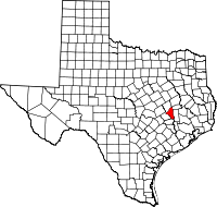
| County | Brazos |
| Area | |
| • Total | 10.2 sq mi (26.4 km2) |
| • Land | 9.2 sq mi (23.7 km2) |
| • Water | 1.0 sq mi (2.7 km2) |
| Elevation | 350 ft (110 m) |
| Population (2010) | |
| • Total | 1,728 |
| • Density | 189/sq mi (72.9/km2) |
| Time zone | Central (CST) (UTC-6) |
| • Summer (DST) | CDT (UTC-5) |
| Area code(s) | 979 |
| FIPS code | 48-40462[1] |
| GNIS feature ID | 2586943[2] |
Lake Bryan is a census-designated place (CDP) in Brazos County, Texas, United States, situated around a reservoir of the same name managed by Bryan Texas Utilities. The population was 1,728 at the 2010 census.[3] It is part of the Bryan–College Station metropolitan area.
Geography
Lake Bryan is located along the northwest border of Brazos County. It is bordered to the southeast by the city of Bryan and to the northwest by Robertson County. U.S. Route 190 forms the northeastern edge of the CDP, leading southeast around Bryan and northwest 13 miles (21 km) to Hearne.
According to the United States Census Bureau, the CDP has a total area of 10.2 square miles (26.4 km2), of which 9.2 square miles (23.7 km2) is land and 1.0 square mile (2.7 km2), or 10.15%, is water.[3]
See also
- Lake Bryan, the reservoir
References
- ↑ "American FactFinder". United States Census Bureau. Retrieved 2008-01-31.
- ↑ "US Board on Geographic Names". United States Geological Survey. 2007-10-25. Retrieved 2008-01-31.
- ↑ 3.0 3.1 "Geographic Identifiers: 2010 Demographic Profile Data (G001): Lake Bryan CDP, Texas". U.S. Census Bureau, American Factfinder. Retrieved April 21, 2014.
| |||||||||||||||||||||||||||||