Lai-Hka Township
| Lai-Hka | |
|---|---|
| Township | |
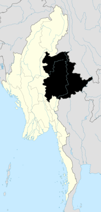
 Lai-Hka Location in Burma | |
| Coordinates: 21°16′20″N 97°39′10″E / 21.27222°N 97.65278°ECoordinates: 21°16′20″N 97°39′10″E / 21.27222°N 97.65278°E | |
| Country |
|
| State | Shan State |
| District | Loilem District |
| Elevation[1] | 971 m (3,186 ft) |
| Time zone | MST (UTC+6.30) |
Lai-Hka Township is a township of Loilen District in the Shan State of Myanmar. The principal town is Lai-Hka.
History
Lai-Hka Township has had a turbulent and unstable history, with conflicts between the Shan State Army-South (SSA-S) and the Burmese Army. In the first half of 2009, there were at least four battles every month and the SPDC retaliated against villagers by confiscating property, extortion and forced relocation.
At the end of July 2009,[2] more than five hundred houses were burnt and 30 villages forcibly relocated in the township of Lai-Hka.[3]
References
- ↑ GoogleEarth
- ↑ Burma Digest
- ↑ "Southern Shan State". Thailand Burma Border Consortium. Retrieved February 28, 2010.
| ||||||||||