Lagayan, Abra
| Lagayan | ||
|---|---|---|
| Municipality | ||
| ||
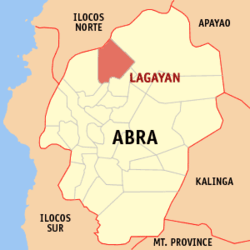 Map of Abra showing the location of Lagayan | ||
.svg.png) Lagayan Location within the Philippines | ||
| Coordinates: 17°43′N 120°42′E / 17.717°N 120.700°ECoordinates: 17°43′N 120°42′E / 17.717°N 120.700°E | ||
| Country | Philippines | |
| Region | Cordillera Administrative Region (CAR) | |
| Province | Abra | |
| District | Lone District of Abra | |
| Barangays | 5 | |
| Government[1] | ||
| • Mayor | Jendricks Seares Luna | |
| Area[2] | ||
| • Total | 215.97 km2 (83.39 sq mi) | |
| Population (2010)[3] | ||
| • Total | 4,477 | |
| • Density | 21/km2 (54/sq mi) | |
| Time zone | PST (UTC+8) | |
| ZIP code | 2824 | |
| Dialing code | 74 | |
| Income class | 5th class municipality | |

Lagayan is a fifth class municipality in the province of Abra, Philippines. According to the 2010 census, it has a population of 4,477 people.[3]
Barangays
Lagayan is politically subdivided into 5 barangays.[2]
| Barangay | Population (2007) |
Population (2010)[3] |
|---|---|---|
| Ba-i | |
|
| Collago | |
|
| Pang-ot | |
|
| Poblacion | |
|
| Pulot | |
|
Demographics
| Population census of Lagayan | ||
|---|---|---|
| Year | Pop. | ±% p.a. |
| 1990 | 3,771 | — |
| 1995 | 3,412 | −1.86% |
| 2000 | 3,894 | +2.87% |
| 2007 | 4,134 | +0.83% |
| 2010 | 4,477 | +2.94% |
| Source: National Statistics Office[3] | ||
References
- ↑ "Official City/Municipal 2013 Election Results". Intramuros, Manila, Philippines: Commission on Elections (COMELEC). 11 September 2013. Retrieved 30 December 2013.
- ↑ 2.0 2.1 "Province: ABRA". PSGC Interactive. Makati City, Philippines: National Statistical Coordination Board. Retrieved 30 December 2013.
- ↑ 3.0 3.1 3.2 3.3 "Total Population by Province, City, Municipality and Barangay: as of May 1, 2010". 2010 Census of Population and Housing. National Statistics Office. Retrieved 30 December 2013.
External links
 |
Nueva Era, Ilocos Norte | | ||
| Danglas | |
Tineg | ||
| ||||
| | ||||
| La Paz | San Juan |
| ||||||||||||||