Lacub, Abra
| Lacub | ||
|---|---|---|
| Municipality | ||
| ||
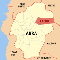 Map of Abra showing the location of Lacub | ||
.svg.png) Lacub Location within the Philippines | ||
| Coordinates: 17°40′N 120°57′E / 17.667°N 120.950°ECoordinates: 17°40′N 120°57′E / 17.667°N 120.950°E | ||
| Country | Philippines | |
| Region | Cordillera Administrative Region (CAR) | |
| Province | Abra | |
| District | Lone District of Abra | |
| Barangays | 6 | |
| Government[1] | ||
| • Mayor | Estelita B. Bersamina | |
| Area[2] | ||
| • Total | 295.30 km2 (114.02 sq mi) | |
| Population (2010)[3] | ||
| • Total | 2,977 | |
| • Density | 10/km2 (26/sq mi) | |
| Time zone | PST (UTC+8) | |
| ZIP code | 2821 | |
| Dialing code | 74 | |
| Income class | 5th class municipality | |

Lacub is a fifth class municipality in the province of Abra, Philippines. According to the 2010 census, it has a population of 2,977 people.[3]
Barangays
Lacub is politically subdivided into 6 barangays.[2]
| Barangay | Population (2007) |
Population (2010)[3] |
|---|---|---|
| Bacag | |
|
| Buneg | |
|
| Guinguinabang | |
|
| Lan-ag | |
|
| Pacoc | |
|
| Poblacion (Talampac) | |
|
Demographics
| Population census of Lacub | ||
|---|---|---|
| Year | Pop. | ±% p.a. |
| 1990 | 2,326 | — |
| 1995 | 2,202 | −1.02% |
| 2000 | 2,782 | +5.14% |
| 2007 | 3,050 | +1.28% |
| 2010 | 2,977 | −0.88% |
| Source: National Statistics Office[3] | ||
References
- ↑ "Official City/Municipal 2013 Election Results". Intramuros, Manila, Philippines: Commission on Elections (COMELEC). 11 September 2013. Retrieved 30 December 2013.
- ↑ 2.0 2.1 "Province: ABRA". PSGC Interactive. Makati City, Philippines: National Statistical Coordination Board. Retrieved 30 December 2013.
- ↑ 3.0 3.1 3.2 3.3 "Total Population by Province, City, Municipality and Barangay: as of May 1, 2010". 2010 Census of Population and Housing. National Statistics Office. Retrieved 30 December 2013.
External links
 |
Tineg | | ||
| Tineg | |
Conner, Apayao | ||
| ||||
| | ||||
| Lagangilang | Licuan-Baay / Malibcong | Balbalan, Kalinga |
| ||||||||||||||