Labrador, Pangasinan
| Labrador | ||
|---|---|---|
| Municipality | ||
|
Poblacion and Municipal Hall | ||
| ||
 Map of Pangasinan showing the location of Labrador | ||
.svg.png) Labrador Location within the Philippines | ||
| Coordinates: 16°00′N 120°07′E / 16.000°N 120.117°ECoordinates: 16°00′N 120°07′E / 16.000°N 120.117°E | ||
| Country |
| |
| Region | Ilocos (Region I) | |
| Province | Pangasinan | |
| District | 2nd district of Pangasinan | |
| Founded | May 15, 1957 | |
| Barangays | 10 | |
| Government[1] | ||
| • Mayor | Ricardo O. Camacho | |
| Area[2] | ||
| • Total | 90.99 km2 (35.13 sq mi) | |
| Population (2010)[3] | ||
| • Total | 21,149 | |
| • Density | 230/km2 (600/sq mi) | |
| Time zone | PST (UTC+8) | |
| ZIP code | 2402 | |
| Dialing code | 75 | |
| Income class | 4th class; rural | |


Labrador is a fourth class municipality in the province of Pangasinan, Philippines. According to the 2010 census, it has a population of 21,149 people.[3]
Barangays
Labrador is politically subdivided into 10 barangays.[2]
- Bolo (*Kadampat, *Quiray)
- Bongalon
- Dulig
- Laois
- Magsaysay
- Poblacion
- San Gonzalo
- San Jose
- Tobuan
- Uyong
Demographics
| Population census of Labrador | ||
|---|---|---|
| Year | Pop. | ±% p.a. |
| 1990 | 15,229 | — |
| 1995 | 16,706 | +1.75% |
| 2000 | 19,115 | +2.93% |
| 2007 | 20,508 | +0.97% |
| 2010 | 21,149 | +1.13% |
| Source: National Statistics Office[3][4] | ||
Images
-

Public Market
-

Highway and downtown
-
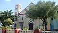
St. Isidore the Farmer Parish Church (Poblacion)
-
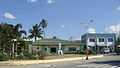
Police Station & Municipal Hospital (Poblacion)
-
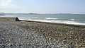
Laois beaches along coastal shores of Lingayen Gulf
-
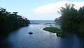
Uyong river, beaches and shores
References
- ↑ "Municipalities". Quezon City, Philippines: Department of the Interior and Local Government. Retrieved 26 November 2012.
- ↑ 2.0 2.1 "Province: PANGASINAN". PSGC Interactive. Makati City, Philippines: National Statistical Coordination Board. Retrieved 26 November 2012.
- ↑ 3.0 3.1 3.2 "Total Population by Province, City, Municipality and Barangay: as of May 1, 2010". 2010 Census of Population and Housing. National Statistics Office. Retrieved 26 November 2012.
- ↑ "Province of Pangasinan". Municipality Population Data. LWUA Research Division. Retrieved 5 September 2013.
External links
| Wikimedia Commons has media related to Labrador, Pangasinan. |
- Philippine Standard Geographic Code
- Philippine Census Information
- Local Governance Performance Management System
- http://pangasinan.org/labrador/
 |
Sual | Lingayen Gulf | | |
| |
Lingayen | |||
| ||||
| | ||||
| Mabini | |
Bugallon |
| ||||||||||||||||||||||