Labastide-Saint-Pierre
| Labastide-Saint-Pierre | ||
|---|---|---|
|
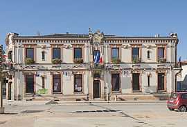
Town hall | ||
| ||
 Labastide-Saint-Pierre | ||
|
Location within Midi-Pyrénées region  Labastide-Saint-Pierre | ||
| Coordinates: 43°55′09″N 1°22′06″E / 43.9192°N 1.3683°ECoordinates: 43°55′09″N 1°22′06″E / 43.9192°N 1.3683°E | ||
| Country | France | |
| Region | Midi-Pyrénées | |
| Department | Tarn-et-Garonne | |
| Arrondissement | Montauban | |
| Canton | Grisolles | |
| Intercommunality | Terroir Grisolles Villebrumier | |
| Government | ||
| • Mayor (2008–2014) | Jérome Beq | |
| Area1 | 20.64 km2 (7.97 sq mi) | |
| Population (2006)2 | 3,556 | |
| • Density | 170/km2 (450/sq mi) | |
| INSEE/Postal code | 82079 / 82370 | |
| Elevation |
75–119 m (246–390 ft) (avg. 102 m or 335 ft) | |
|
1 French Land Register data, which excludes lakes, ponds, glaciers > 1 km² (0.386 sq mi or 247 acres) and river estuaries. 2 Population without double counting: residents of multiple communes (e.g., students and military personnel) only counted once. | ||
.svg.png)
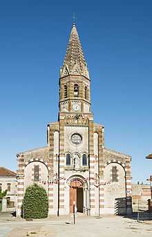
The church
Labastide-Saint-Pierre is a commune in the Tarn-et-Garonne department in the Midi-Pyrénées region in southern France.
See also
References
| Wikimedia Commons has media related to Labastide-Saint-Pierre. |