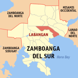
Labangan, Zamboanga del Sur
Labangan is a third class municipality in the province of Zamboanga del Sur, Philippines. According to the 2010 census, it has a population of 39,168 people.[3]
Barangays
Labangan is politically subdivided into 25 barangays.[2]
- Bagalupa
- Balimbingan (West Luya)
- Binayan
- Bokong
- Bulanit
- Cogonan
- Combo
- Dalapang
- Dimasangca
- Dipaya
- Langapod
- Lantian
- Lower Campo Islam (Pob.)
- Lower Pulacan
- Lower Sang-an
- New Labangan
- Noboran
- Old Labangan
- San Isidro
- Santa Cruz
- Tapodoc
- Tawagan Norte
- Upper Campo Islam (Pob.)
- Upper Pulacan
- Upper Sang-an
Demographics
| Population census of Labangan |
|---|
| Year | Pop. | ±% p.a. |
|---|
| 1990 | 29,229 | — |
|---|
| 1995 | 32,264 | +1.87% |
|---|
| 2000 | 34,530 | +1.47% |
|---|
| 2007 | 37,598 | +1.18% |
|---|
| 2010 | 39,168 | +1.50% |
|---|
| Source: National Statistics Office[3] |
Attractions
- Pulacan Falls - 12 km. from Pagadian City, and covering an area of 400 square meters. It is the source of water for the Labangan irrigation system. Two kilometers from the area is the 134-hectare Home Defense Center. The falls can be reached easily by any motor vehicle. With the opening of the PADAP road, Pulacan Falls became a beautiful camping and picnic site. It now has a permanent Boy and Girl Scout site with facilities and has been the location of regional and provincial jamborees.
- Army Site - The new division site of 1st Infantry (TABAK) Division, Philippine Army, is located on the top of the Hill of Kuta Major Cesar L Sang-an.
References
External links

.svg.png)

