La Ronciere Island
| Russian: Остров Ла-Ронсьер | |
|---|---|
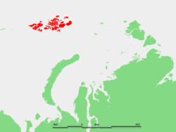 Location of the Franz Josef Archipelago. | |
| Geography | |
| Location | Arctic |
| Coordinates | 80°58′56″N 60°59′39″E / 80.9822°N 60.9942°E |
| Archipelago | Franz Josef Archipelago |
| Area | 478 km2 (185 sq mi) |
| Highest elevation | 431 m (1,414 ft) |
| Country | |
| Demographics | |
| Population | 0 |
La Ronciere Island (Russian: Остров Ла-Ронсьер; Ostrov La-Ronsier. Also known as Ronser Island is an island in Franz Josef Land, Russia.
La Ronciere Island's area is 478 km2 (185 sq mi). Its latitude is 81° N and its longitude 61° E. The highest point of the island is 431 m (1,414 ft). It is almost completely glaciarized except for two small points by the shore in the northeast and in the west.
La Ronciere Island lies north of Wilczek Land, separated from it by an 8 km (5 mi) wide sound.
This island was named by the Austro-Hungarian North Pole Expedition after Captain La Ronciere Le Noury, a French courier for Austro-Hungarian Emperor Franz Joseph.
In some maps La Ronciere Island appears as "Whitney Island", after American Arctic explorer Harry Whitney. This name was given by the Ziegler-Fiala Polar Expedition, but the Austro-Hungarian explorers that discovered Franz Josef land had named this island first.
Coordinates: 80°58′56″N 60°59′39″E / 80.9822°N 60.9942°E
Adjacent islands
- 6 km (3.7 mi) southwest of La Ronciere Island and 4 km north of Wilczek Land's northwestern cape, at 80.8716667 N 60.1172222 E, lies a small island called Ostrov Geidzh (Остров Гейдж) or Geddes Island. This barely 1 km (0.62 mi) long island was named after Scottish polar scientist Sir Patrick Geddes. This same island was named Hayden Island (Остров Гайдана; Ostrov Gaydana), after pioneering American geologist Ferdinand Vandeveer Hayden, by the Ziegler-Fiala expedition.