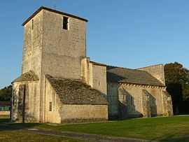
La Rochette, Charente
| La Rochette | |
|---|---|
 | |
 La Rochette | |
|
Location within Poitou-Charentes region 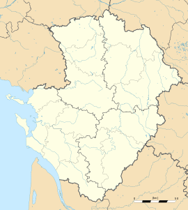 La Rochette | |
| Coordinates: 45°48′07″N 0°18′53″E / 45.8019°N 0.3147°ECoordinates: 45°48′07″N 0°18′53″E / 45.8019°N 0.3147°E | |
| Country | France |
| Region | Poitou-Charentes |
| Department | Charente |
| Arrondissement | Angoulême |
| Canton | La Rochefoucauld |
| Intercommunality | Bandiat-Tardoire |
| Government | |
| • Mayor (2008–2014) | Laurent Banicic |
| Area1 | 10.99 km2 (4.24 sq mi) |
| Population (2008)2 | 551 |
| • Density | 50/km2 (130/sq mi) |
| INSEE/Postal code | 16282 / 16110 |
| Elevation |
66–115 m (217–377 ft) (avg. 91 m or 299 ft) |
|
1 French Land Register data, which excludes lakes, ponds, glaciers > 1 km² (0.386 sq mi or 247 acres) and river estuaries. 2 Population without double counting: residents of multiple communes (e.g., students and military personnel) only counted once. | |
La Rochette is a commune in the Charente department in southwestern France.
Population
| Historical population | ||
|---|---|---|
| Year | Pop. | ±% |
| 1800 | 767 | — |
| 1806 | 748 | −2.5% |
| 1821 | 742 | −0.8% |
| 1831 | 864 | +16.4% |
| 1841 | 801 | −7.3% |
| 1846 | 805 | +0.5% |
| 1851 | 851 | +5.7% |
| 1856 | 765 | −10.1% |
| 1861 | 760 | −0.7% |
| 1866 | 793 | +4.3% |
| 1872 | 654 | −17.5% |
| 1876 | 636 | −2.8% |
| 1881 | 631 | −0.8% |
| 1886 | 638 | +1.1% |
| 1891 | 595 | −6.7% |
| 1896 | 609 | +2.4% |
| 1901 | 575 | −5.6% |
| 1906 | 529 | −8.0% |
| 1911 | 549 | +3.8% |
| 1921 | 501 | −8.7% |
| 1926 | 480 | −4.2% |
| 1931 | 440 | −8.3% |
| 1936 | 500 | +13.6% |
| 1946 | 391 | −21.8% |
| 1954 | 393 | +0.5% |
| 1962 | 398 | +1.3% |
| 1968 | 401 | +0.8% |
| 1975 | 422 | +5.2% |
| 1982 | 436 | +3.3% |
| 1990 | 445 | +2.1% |
| 1999 | 442 | −0.7% |
| 2008 | 551 | +24.7% |
See also
References
| Wikimedia Commons has media related to La Rochette (Charente). |