La Rioja, Argentina
| La Rioja | |
|---|---|
| City | |
|
| |
 La Rioja Location of La Rioja in Argentina | |
| Coordinates: 29°24′45″S 66°51′15″W / 29.41250°S 66.85417°WCoordinates: 29°24′45″S 66°51′15″W / 29.41250°S 66.85417°W | |
| Country | Argentina |
| Province | La Rioja |
| Department | Capital |
| Founded | 1591 |
| Elevation | 515 m (1,690 ft) |
| Population (2010 census [INDEC]) | |
| • Total | 180,995 |
| Time zone | ART (UTC−3) |
| CPA base | F5300 |
| Dialing code | +54 3822 |
| Website | Official website |
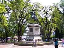
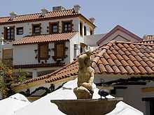
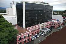
La Rioja is the capital city of the Argentine province of La Rioja, located in the east of the province. The city has a population of almost 150,000 according to the 2001 census [INDEC].
La Rioja is located on the foot of the Velasco Sierras, 1,167 km (725 mi) from Buenos Aires, and 430 km (267 mi) from Córdoba.
Former president Isabel Martínez de Perón was born in La Rioja. Another former president, Carlos Menem, was born nearby.
Climate
La Rioja has a semi-arid climate (BSh, according to the Köppen climate classification), with average temperatures of 5 °C (41 °F) to 19 °C (66 °F) winter and 21 °C (70 °F) to 35 °C (95 °F) in summer, but with maximum temperatures of more than 45 °C (113 °F). The average annual rainfall is 411.4 mm (16 in), falling almost exclusively during the summer when moist tropical air from the northeast enters the region.
| Climate data for La Rioja Aero, Argentina (1961–1990) | |||||||||||||
|---|---|---|---|---|---|---|---|---|---|---|---|---|---|
| Month | Jan | Feb | Mar | Apr | May | Jun | Jul | Aug | Sep | Oct | Nov | Dec | Year |
| Record high °C (°F) | 45.1 (113.2) |
43.6 (110.5) |
41.4 (106.5) |
38.0 (100.4) |
34.4 (93.9) |
29.9 (85.8) |
37.3 (99.1) |
37.3 (99.1) |
40.7 (105.3) |
41.3 (106.3) |
43.1 (109.6) |
46.4 (115.5) |
46.4 (115.5) |
| Average high °C (°F) | 35.0 (95) |
33.3 (91.9) |
30.4 (86.7) |
27.2 (81) |
23.4 (74.1) |
19.4 (66.9) |
19.7 (67.5) |
23.0 (73.4) |
26.1 (79) |
30.6 (87.1) |
33.3 (91.9) |
35.0 (95) |
28.0 (82.4) |
| Daily mean °C (°F) | 27.4 (81.3) |
25.9 (78.6) |
23.4 (74.1) |
19.8 (67.6) |
15.5 (59.9) |
11.1 (52) |
10.9 (51.6) |
14.0 (57.2) |
17.8 (64) |
22.5 (72.5) |
25.4 (77.7) |
27.2 (81) |
20.1 (68.2) |
| Average low °C (°F) | 20.7 (69.3) |
19.7 (67.5) |
17.9 (64.2) |
14.1 (57.4) |
9.6 (49.3) |
4.9 (40.8) |
4.4 (39.9) |
6.5 (43.7) |
10.3 (50.5) |
15.2 (59.4) |
18.2 (64.8) |
20.3 (68.5) |
13.5 (56.3) |
| Record low °C (°F) | 10.7 (51.3) |
10.7 (51.3) |
8.8 (47.8) |
1.8 (35.2) |
−2.8 (27) |
−4.9 (23.2) |
−5.4 (22.3) |
−4.1 (24.6) |
−0.6 (30.9) |
5.0 (41) |
7.1 (44.8) |
7.7 (45.9) |
−5.4 (22.3) |
| Average precipitation mm (inches) | 80.1 (3.154) |
71.6 (2.819) |
54.1 (2.13) |
18.4 (0.724) |
7.4 (0.291) |
2.6 (0.102) |
3.1 (0.122) |
5.2 (0.205) |
6.5 (0.256) |
12.7 (0.5) |
43.3 (1.705) |
56.6 (2.228) |
361.6 (14.236) |
| Avg. precipitation days (≥ 0.1 mm) | 9 | 8 | 6 | 4 | 2 | 1 | 1 | 1 | 2 | 2 | 5 | 7 | 48 |
| Average relative humidity (%) | 60 | 65 | 69 | 69 | 69 | 68 | 64 | 53 | 49 | 48 | 51 | 55 | 60 |
| Source #1: NOAA[1] | |||||||||||||
| Source #2: Servicio Meteorológico Nacional (precipitation days)[2] | |||||||||||||
History

It was founded in 1591 by the governor of Tucumán Province.[3]


La Rioja was always the principal settlement of the province. The only time it was surpassed in population was in the mid-19th century when Chilecito, a small settlement near the Chilean border based around the Hacienda Santa Rita, became the largest town in the province. It wasn't until the early 20th century that La Rioja regained the status of being the largest city.
Economy
The economy of the entire province is historically tied to cattle farming and agriculture, as well as wine production. But the beginning of the 1970s brought to the city an industrialisation thrust that makes La Rioja today an important centre in Argentina's pharmacological industry.
References
- ↑ "La Rioja Aero Climate Normals 1961–1990". National Oceanic and Atmospheric Administration. Retrieved March 15, 2015.
- ↑ "La Rioja Aero". 19 August 2012. Retrieved 19 August 2012.
- ↑ "La Rioja". Encyclopaedia Britannica. Retrieved 5 December 2012.
External links
| Wikimedia Commons has media related to La Rioja, La Rioja (Argentina). |
- Official page (Spanish)
- Municipal information: Municipal Affairs Federal Institute (IFAM), Municipal Affairs Secretariat, Ministry of Interior, Argentina. (Spanish)
- City Information (English)
- Universidad Nacional de La Rioja (Spanish)