La Piarre
| La Piarre | |
|---|---|
 La Piarre | |
|
Location within Provence-A.-C.d'A. region 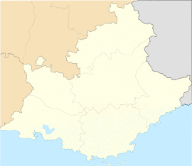 La Piarre | |
| Coordinates: 44°28′34″N 5°39′23″E / 44.4761°N 5.6564°ECoordinates: 44°28′34″N 5°39′23″E / 44.4761°N 5.6564°E | |
| Country | France |
| Region | Provence-Alpes-Côte d'Azur |
| Department | Hautes-Alpes |
| Arrondissement | Gap |
| Canton | Serres |
| Intercommunality | Serres |
| Government | |
| • Mayor (2008–2014) | Éric Oddou |
| Area1 | 21.67 km2 (8.37 sq mi) |
| Population (2008)2 | 96 |
| • Density | 4.4/km2 (11/sq mi) |
| INSEE/Postal code | 05102 / 05700 |
| Elevation |
760–1,760 m (2,490–5,770 ft) (avg. 880 m or 2,890 ft) |
|
1 French Land Register data, which excludes lakes, ponds, glaciers > 1 km² (0.386 sq mi or 247 acres) and river estuaries. 2 Population without double counting: residents of multiple communes (e.g., students and military personnel) only counted once. | |
La Piarre is a commune in the Hautes-Alpes department in southeastern France.
Population
| Historical population | ||
|---|---|---|
| Year | Pop. | ±% |
| 1962 | 60 | — |
| 1968 | 77 | +28.3% |
| 1975 | 62 | −19.5% |
| 1982 | 61 | −1.6% |
| 1990 | 57 | −6.6% |
| 1999 | 63 | +10.5% |
| 2008 | 96 | +52.4% |
See also
References
| Wikimedia Commons has media related to La Piarre. |