La Paz County, Arizona
Coordinates: 33°50′25″N 113°56′34″W / 33.84028°N 113.94278°W
| La Paz County, Arizona | ||
|---|---|---|
| ||
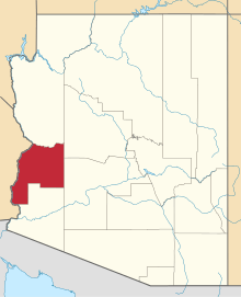 Location in the state of Arizona | ||
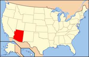 Arizona's location in the U.S. | ||
| Founded | January 1, 1983 | |
| Seat | Parker | |
| Largest town | Quartzsite | |
| Area | ||
| • Total | 4,514 sq mi (11,691 km2) | |
| • Land | 4,500 sq mi (11,655 km2) | |
| • Water | 14 sq mi (36 km2), 0.3% | |
| Population (Est.) | ||
| • (2014) | 20,231 | |
| • Density | 4.6/sq mi (2/km²) | |
| Congressional district | 4th | |
| Time zone | Mountain: UTC-7 | |
| Website |
www | |


La Paz County is a county in the western part of the U.S. state of Arizona. As of the 2010 census, its population was 20,489,[1] making it the second-least populous county in Arizona. The county seat is Parker.[2] The name of the county is the Spanish word for the peace, and is taken from the early settlement (now ghost town) of La Paz along the Colorado River.
La Paz County was established in 1983 after voters approved separating the northern portion of Yuma County, making it the only county to be established after Arizona became a state in 1912. The county did not have a large enough tax base to begin supporting a separate county government immediately and had to rely on state money at first. As a result Arizona laws were changed to make splitting other existing counties much more difficult.
The Colorado River Indian Reservation is located in the western portion of the county. Part of the reservation extends westward into San Bernardino and Riverside Counties in California.
Geography
According to the U.S. Census Bureau, the county has a total area of 4,514 square miles (11,690 km2), of which 4,500 square miles (12,000 km2) is land and 14 square miles (36 km2) (0.3%) is water.[3]
Flora and fauna

There are a variety of flora and fauna associated with La Paz County.[4] The endangered California Fan Palm, Washingtonia filifera has a small number of grove occurrences within the county.[5]
Adjacent counties
- Mohave County, Arizona - north
- Yavapai County, Arizona - northeast
- Maricopa County, Arizona - east
- Yuma County, Arizona - south
- Imperial County, California - southwest
- Riverside County, California - west
- San Bernardino County, California - northwest
National protected areas
- Bill Williams River National Wildlife Refuge (part)
- Cibola National Wildlife Refuge (part)
- Imperial National Wildlife Refuge (part)
- Kofa National Wildlife Refuge (part)
Transportation
Major highways
.svg.png) Interstate 10
Interstate 10 U.S. Route 95
 U.S. Route 60
 State Route 72
 State Route 95
Airports
Avi Suquilla Airport (FAA LID: P20) is a public use airport located one nautical mile (1.8 km) east of the central business district of Parker, a town in La Paz County. It is owned by the Colorado River Indian Tribes.
Demographics
| Historical population | |||
|---|---|---|---|
| Census | Pop. | %± | |
| 1990 | 13,844 | — | |
| 2000 | 19,715 | 42.4% | |
| 2010 | 20,489 | 3.9% | |
| Est. 2014 | 20,231 | −1.3% | |
| U.S. Decennial Census[6] 1990-2000[7] 2010-2014[1] | |||
2010
Whereas according to the 2010 U.S. Census Bureau:
- 69.8% White
- 0.6% Black
- 12.8% Native American
- 0.5% Asian
- 0.0% Native Hawaiian or Pacific Islander
- 3.7% Two or more races
- 12.6% Other races
- 23.5% Hispanic or Latino (of any race)
2000
As of the 2000 census, there were 19,715 people, 8,362 households, and 5,619 families residing in the county. The population density was 4 people per square mile (2/km²). There were 15,133 housing units at an average density of 3 per square mile (1/km²). The racial makeup of the county was 74.15% white, 0.79% black or African American, 12.53% Native American, 0.41% Asian, 0.10% Pacific Islander, 9.35% from other races, and 2.68% from two or more races. 22.42% of the population were Hispanic or Latino of any race. 18.90% reported speaking Spanish at home .
There were 8,362 households out of which 21.20% had children under the age of 18 living with them, 54.20% were married couples living together, 8.20% had a female householder with no husband present, and 32.80% were non-families. 26.60% of all households were made up of individuals and 12.90% had someone living alone who was 65 years of age or older. The average household size was 2.32 and the average family size was 2.79.
In the county the population was spread out with 21.10% under the age of 18, 6.10% from 18 to 24, 20.40% from 25 to 44, 26.60% from 45 to 64, and 25.80% who were 65 years of age or older. The median age was 47 years. For every 100 females there were 105.50 males. For every 100 females age 18 and over, there were 105.10 males.
The median income for a household in the county was $25,839, and the median income for a family was $29,141. Males had a median income of $26,642 versus $20,965 for females. The per capita income for the county was $14,916. About 13.60% of families and 19.60% of the population were below the poverty line, including 28.50% of those under age 18 and 12.90% of those age 65 or over.
Communities

Towns
- Parker (County Seat)
- Quartzsite
Census-designated places
Unincorporated community
Ghost towns
County Population Ranking
The population ranking of the following table is based on the 2010 census of La Paz County.[8][9]
† county seat
| Rank | City/Town/etc. | Population (2010 Census) | Municipal type | Incorporated |
|---|---|---|---|---|
| 1 | Quartzsite | 3,677 | Town | 1989 |
| 2 | † Parker | 3,083 | Town | |
| 3 | Cienega Springs | 1,798 | CDP | |
| 4 | Salome | 1,530 | CDP | |
| 5 | Ehrenburg | 1,470 | CDP | |
| 6 | Bouse | 996 | CDP | |
| 7 | Wenden | 728 | CDP | |
| 8 | Bluewater | 725 | CDP | |
| 9 | La Paz Valley | 699 | CDP | |
| 10 | Brenda | 676 | CDP | |
| 11 | Parker Strip | 662 | CDP | |
| 12 | Vicksburg | 597 | CDP | |
| 13 | Poston | 285 | CDP | |
| 14 | Cibola | 250 | CDP | |
| 15 | Utting | 126 | CDP | |
| 16 | Alamo Lake | 25 | CDP | |
| 17 | Sunwest | 15 | CDP |
See also
References
- ↑ 1.0 1.1 "State & County QuickFacts". United States Census Bureau. Retrieved May 18, 2014.
- ↑ "Find a County". National Association of Counties. Retrieved 2011-06-07.
- ↑ "US Gazetteer files: 2010, 2000, and 1990". United States Census Bureau. 2011-02-12. Retrieved 2011-04-23.
- ↑ Forrest Shreve and Ira Loren Wiggins. 1964. Vegetation and flora of the Sonoran Desert, p 50 et seq., Stanford University Press, 1740 pages ISBN 0-8047-0163-6, ISBN 978-0-8047-0163-1.
- ↑ C. Michael Hogan. 2009. California Fan Palm: Washingtonia filifera, GlobalTwitcher.com, ed. Nicklas Stromberg
- ↑ "U.S. Decennial Census". United States Census Bureau. Retrieved May 18, 2014.
- ↑ "Census 2000 PHC-T-4. Ranking Tables for Counties: 1990 and 2000" (PDF). United States Census Bureau. Retrieved May 18, 2014.
- ↑ http://www.census.gov/2010census/
- ↑ http://www.census.gov/geo/maps-data/maps/block/2010/
External links
| Wikimedia Commons has media related to La Paz County, Arizona. |
- County website
- "Bills tackle county growth", Arizona Republic, Feb. 10, 2005
- "Arizona County Formation", Arizona Association of Counties
 |
San Bernardino County, California | Mohave County | Yavapai County | |
| Riverside County, California | |
Maricopa County | ||
| ||||
| | ||||
| Imperial County, California | Yuma County |
| |||||||||||||||||||||||||||||