La Paz, Abra
| La Paz | ||
|---|---|---|
| Municipality | ||
| ||
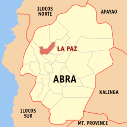 Map of Abra showing the location of La Paz | ||
.svg.png) La Paz Location within the Philippines | ||
| Coordinates: 17°42′20″N 120°41′35″E / 17.70556°N 120.69306°ECoordinates: 17°42′20″N 120°41′35″E / 17.70556°N 120.69306°E | ||
| Country | Philippines | |
| Region | Cordillera Administrative Region (CAR) | |
| Province | Abra | |
| District | Lone District of Abra | |
| Barangays | 12 | |
| Government[1] | ||
| • Mayor | Joseph Sto. Niño B. Bernos | |
| Area[2] | ||
| • Total | 51.41 km2 (19.85 sq mi) | |
| Population (2010)[3] | ||
| • Total | 14,882 | |
| • Density | 290/km2 (750/sq mi) | |
| Time zone | PST (UTC+8) | |
| ZIP code | 2826 | |
| Dialing code | 74 | |
| Income class | 5th class municipality | |

La Paz is a fifth class municipality in the province of Abra, Philippines. According to the 2010 census, it has a population of 14,882 people.[3]
Barangays
La Paz is politically subdivided into 12 barangays.[2]
| Barangay | Population (2007) |
Population (2010)[3] |
|---|---|---|
| Benben (Bonbon) | |
|
| Bulbulala | |
|
| Buli | | |
| Canan (Gapan) | |
|
| Liguis | |
|
| Malabbaga | |
|
| Mudeng | |
|
| Pidipid | |
|
| Poblacion | |
|
| San Gregorio | |
|
| Toon | |
|
| Udangan | |
|
Demographics
| Population census of La Paz | ||
|---|---|---|
| Year | Pop. | ±% p.a. |
| 1990 | 11,240 | — |
| 1995 | 11,756 | +0.84% |
| 2000 | 12,922 | +2.05% |
| 2007 | 14,658 | +1.75% |
| 2010 | 14,882 | +0.55% |
| Source: National Statistics Office[3] | ||
References
- ↑ "Official City/Municipal 2013 Election Results". Intramuros, Manila, Philippines: Commission on Elections (COMELEC). 11 September 2013. Retrieved 30 December 2013.
- ↑ 2.0 2.1 "Province: ABRA". PSGC Interactive. Makati City, Philippines: National Statistical Coordination Board. Retrieved 30 December 2013.
- ↑ 3.0 3.1 3.2 3.3 "Total Population by Province, City, Municipality and Barangay: as of May 1, 2010". 2010 Census of Population and Housing. National Statistics Office. Retrieved 30 December 2013.
External links
 |
Danglas | Lagayan | | |
| Bangued | |
San Juan Dolores | ||
| ||||
| | ||||
| Tayum |
| ||||||||||||||