La Hourquette d'Ancizan
| La Hourquette d'Ancizan | |
|---|---|
 | |
| Elevation | 1,564 m (5,131 ft)[1] |
| Traversed by | D113 |
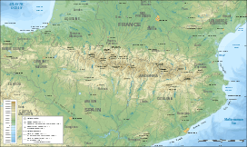
| Location | Hautes-Pyrénées, France |
| Range | Pyrenees |
| Coordinates | 42°54′01″N 0°18′19″E / 42.90028°N 0.30528°ECoordinates: 42°54′01″N 0°18′19″E / 42.90028°N 0.30528°E |
 La Hourquette d'Ancizan Location of La Hourquette d'Ancizan | |

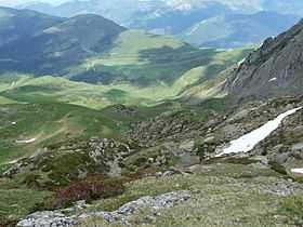
La Hourquette d'Ancizan (elevation 1,564 m (5,131 ft)) is a mountain pass in the French Pyrenees in the department of Hautes-Pyrénées, between the communities of Ancizan (east) and Campan (west).
Toponymy
The word "Hourquette" is derived from the Gascon word "hurketɵ" meaning "farm". Or, according to French Wikipedia,[2] the Gascon word comes from the Latin furca meaning a fork.
Details of climb
Starting from Ancizan, the climb is 10.3 km (6.4 mi) long. Over this distance, the climb is 805 m (2,641 ft) (an average of 7.8%). After Ancizan, the road goes up sharply, with stretches of 15% in the first kilometre, but after the first 3 km (1.9 mi), the climb becomes more moderate.[3]
Starting from Campan, the climb is 22.6 km (14.0 mi) long. Over this distance, the climb is 904 m (2,966 ft) (an average of 4.0%), with the steepest section being at 10.0%.[4]
Appearances in Tour de France
La Hourquette d'Ancizan was first used in the Tour de France on stage 12 of the 2011 tour, when the leader over the summit was Laurent Mangel.[5]
References
- ↑ IGN map
- ↑ fr:Hourquette d'Ancizan
- ↑ "Hourquette d'Ancizan – Ancizan". www.climbbybike.com. Retrieved 19 September 2011.
- ↑ "Hourquette d'Ancizan – Campan". www.climbbybike.com. Retrieved 19 September 2011.
- ↑ "La Hourquette d'Ancizan dans le Tour de France" (in French). Retrieved 19 September 2011.