La Chapelle-d'Angillon
| La Chapelle-d’Angillon | ||
|---|---|---|
|
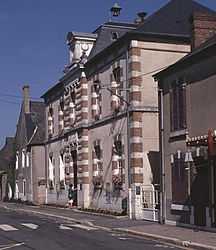
The town hall and school in La Chapelle-d'Angillon | ||
| ||
 La Chapelle-d’Angillon | ||
|
Location within Centre region  La Chapelle-d’Angillon | ||
| Coordinates: 47°21′51″N 2°26′02″E / 47.3642°N 2.4339°ECoordinates: 47°21′51″N 2°26′02″E / 47.3642°N 2.4339°E | ||
| Country | France | |
| Region | Centre-Val de Loire | |
| Department | Cher | |
| Arrondissement | Vierzon | |
| Canton | Chapelle-d'Angillon | |
| Intercommunality | Sauldre et Sologne | |
| Government | ||
| • Mayor (2008–2015) | Guy Amelot | |
| Area1 | 10.17 km2 (3.93 sq mi) | |
| Population (2008)2 | 665 | |
| • Density | 65/km2 (170/sq mi) | |
| INSEE/Postal code | 18047 / 18380 | |
| Elevation |
183–283 m (600–928 ft) (avg. 192 m or 630 ft) | |
|
1 French Land Register data, which excludes lakes, ponds, glaciers > 1 km² (0.386 sq mi or 247 acres) and river estuaries. 2 Population without double counting: residents of multiple communes (e.g., students and military personnel) only counted once. | ||

La Chapelle-d’Angillon is a commune in the Cher department in the Centre region of France.
Geography
A village of lakes, forestry and farming situated in the valley of the river Sauldre, some 20 miles (32 km) north of Bourges at the junction of the D12, D940 and the D926 roads.
Population
| Historical population | ||
|---|---|---|
| Year | Pop. | ±% |
| 1962 | 686 | — |
| 1968 | 727 | +6.0% |
| 1975 | 744 | +2.3% |
| 1982 | 756 | +1.6% |
| 1990 | 687 | −9.1% |
| 1999 | 667 | −2.9% |
| 2008 | 665 | −0.3% |
Personalities
- Alain-Fournier (Henri Alban-Fournier), writer, was born here on October 3, 1886.
Sights
- The church, dating from the fifteenth century.
- The chateau of Béthune, with parts dating from the twelfth century.
- A museum, in the chateau, dedicated to Alain-Fournier.
See also
References
External links
| Wikimedia Commons has media related to La Chapelle-d'Angillon. |
- Photo of Alain-Fournier’s family home (French)
- Official website of the château (French)
- Chapelle-d’Angillon La Chapelle-d’Angillon on the Quid website (French)