La Brèche de Roland
| La Brèche de Roland | |
|---|---|
| Brecha de Rolando | |
|
La Brèche de Roland, seen from the French side. | |
| Elevation | 2,804 m (9,199 ft) |
| Traversed by | foot |
| Location |
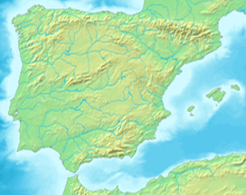
Hautes-Pyrénées, France Aragón, Spain |
| Range | Pyrenees |
| Coordinates | 42°41′27″N 00°02′01″W / 42.69083°N 0.03361°WCoordinates: 42°41′27″N 00°02′01″W / 42.69083°N 0.03361°W |
 Brecha de Rolando Location of La Brèche de Roland | |
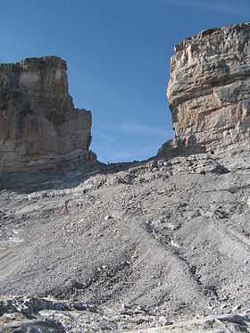
La Brèche de Roland[1] is the name of a natural gap, 40 m across and 100 m high, at an elevation of 2804 m in the Pyrenees on the border of Aragón, northern Spain. and Hautes-Pyrénées, France. In Spanish the gap is known as Brecha de Rolando and in Aragonese as Breca de Roldán.
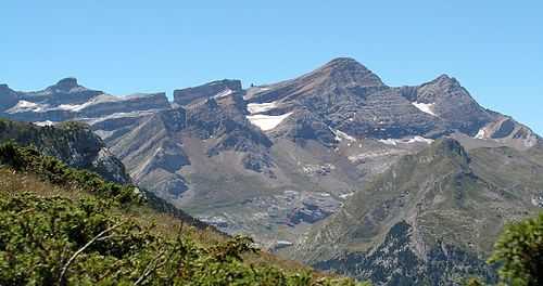
The gap is situated in the Ordesa y Monte Perdido National Park[2] on the Franco-Spanish border, close to the steep cliffs of the Cirque de Gavarnie.
According to legend the Brèche de Roland was cut by Count Roland with his sword Durendal in an attempt to destroy that sword, after being defeated during the Battle of Roncesvalles in 778.
The gap can be reached from the Refugio Sarradets,[3] a nearby mountain shelter, in about an hour's climb.

References
- ↑ "Brecha de Rolando" summitpost.org, retrieved 2013-08-20
- ↑ "Parque Nacional Ordesa y Monte Perdido" archive.org, retrieved 2013-08-20
- ↑ "Refugio Serradets o Brecha de Rolando 2587 m." madteam.net, retrieved 2013-08-20
External links
- "La Brèche de Roland" summitpost.org, retrieved 2013-08-20
- "Taillón (3.144m) por la Brecha de Rolando" rutaspirineos.org, retrieved 2013-08-20 (in Spanish)
- Otras bellas fotos de la brecha de Rolando
| ||||||||||||||||||||||||||