Kyengera
| Kyengera | |
|---|---|
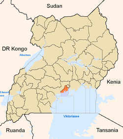
 Kyengera Map of Uganda showing the location of Kyengera | |
| Coordinates: 00°17′46″N 32°30′19″E / 0.29611°N 32.50528°E | |
| Country |
|
| Region | Central Uganda |
| District | Wakiso District |
| County | Busiro |
| Constituency | Busiro South |
| Time zone | EAT (UTC+3) |
Kyengera is a town in Central Uganda. It is one of the urban centers in Wakiso District.[1]
Location
The town is situated on the tarmacked, all-weather Kampala - Masaka Highway. Kyengera is located approximately 9 kilometres (5.6 mi), by road, southwest of Kampala, Uganda's capital and largest city.[2] The coordinates of the town are:0°17'46.0"N, 32°30'19.0"E (Latitude:0.296112; Longitude:32.505275).[3]
Population
As of July 2014, the exact population of Kyengera is not publicly known. The next national population census in Uganda is planned for August 2014.[4]
Points of interest
The following points of interest lie within the town limits or near the edges of town:
- The Kabojja Campus of Islamic University in Uganda (IUIU), which admits females only, is located about 2 kilometres (1.2 mi), east of Kyengera
- The Busega Roundabout in Busega - Located about 4 kilometres (2.5 mi), north Kyengera, the roundabout is the western endpoint of the Kampala Northern Bypass Highway and will be the northern endpoint of the Entebbe Expressway, when construction is completed in 2016.[5]
- A branch of Crane Bank, the largest indigenous commercial bank in Uganda, with total assets of about US$600 million in 2014.[6]
- A branch of Equity Bank
- Kyengera Police Station - An establishment of the Uganda National Police.
See also
References
- ↑ UTG, . (.). "Profile of Wakiso District". Uganda Travel Guide (UTG). Retrieved 2 July 2014. Check date values in:
|date=(help) - ↑ "Map Showing Kampala And Kyengera With Distance Marker". Globefeed.com. Retrieved 2 July 2014.
- ↑ Google, . "Location of Kyengera At Google Maps". Google Maps. Retrieved 2 July 2014.
- ↑ Ninsiima, Racheal (14 July 2013). "Uganda Census Planned for 2014". The Observer (Uganda). Retrieved 2 July 2014.
- ↑ Vision, Reporter (10 May 2014). "Kampala-Entebbe Highway On Track, Chinese Want To Build Railway Line". New Vision. Retrieved 2 July 2014.
- ↑ Daily Monitor Reporter, . (14 November 2014). "UShs200 Billion Crane Bank Expansion Drive Takes Shape With The Opening of The 42nd Branch Along Masaka Road". Daily Monitor (Kampala). Retrieved 15 November 2014.