Kuthiathode
| KUTHIATHODE | |
|---|---|
| village | |
 | |
 KUTHIATHODE Location in Kerala, India | |
| Coordinates: 9°48′0″N 76°20′0″E / 9.80000°N 76.33333°ECoordinates: 9°48′0″N 76°20′0″E / 9.80000°N 76.33333°E | |
| Country |
|
| State | Kerala |
| District | Alappuzha |
| Government | |
| • Body | Panchayat |
| Population (2001) | |
| • Total | 22,880 |
| Languages | |
| • Official | Malayalam, English |
| Time zone | IST (UTC+5:30) |
| PIN | 688533 |
| Telephone code | 0478 |
| Vehicle registration | KL -04/KL-32 |
| Nearest city | Kochi |
| Lok Sabha constituency | Alappuzha |
| Vidhan Sabha constituency | Aroor |
| Civic agency | Panchayat |

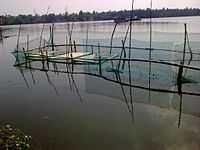
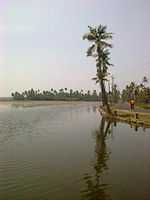
Kuthiathode is a gram panchayat in Alappuzha district in the Indian state of Kerala.[1] Kuthiathode comes under the Pattanakad Block in Aroor Assembly constituency.The name Kuthiathode comes from Kuthia (dug)+ thode (canal) means a dug-canal.The Kuthiathode or the river stream was once the major waterway for transporting goods to the local market from Kochi via the Vembanad lake.The local market on both sides of the river was a major commercial hub around the locality. Even now the market exists with few wholesale traders selling vegetables,provisions.The Kuthiathode river connects the vembanad lake with the Tazappu backwaters on the western side. The Panchayat has a Gandhi memorial inside its office dedicated to Mahathma Gandhi who visited this place during the Pre-Independence period .The Panchayat office has library and a community hall.The Range Excise office is next to the Panchayat building.The Kuthiathode village office,Krishi Bhavan,Govt. Veterinary Clinic and a Sub-treasury also functions in Kuthiathode. The BSNL telephone exchange functions near the Kuthiathode Jamat mosque. The greenary of paddy fields on both sides of the Pallithode-Chavady road is really splendid. One can enjoy the evening panoramic view of Chinese fishing nets across the Pallithode backwaters from the Pallithode bridge.A small backwater lake at Tazzupu connects Kuthiathode with Valiathode.During Onam boat racing is held in Tazzupu backwaters and attracts many seasonal tourists.
Kuthiathode, Parayakad, Nallukulanagara, Pallithode, Chapakadavu, Tirumalabhagom, Tazappu, Thuravoor North, and Valamangalam North are the local areas covered under the Panchayat. The vast agricultural lands on the western side or the Thuravoor Kari where large scale paddy cultivation and shrimp farming is done annually and serves as the seasonal livelihood for many of them . The population consists of Ezhavas, Nairs, Nampoothiris, Tulu Brahmins, Vermas, Tamil Brahmins,Goldsmiths, Viswakarmas, Gouda Saraswat Brahmins, Pulayas,Parayas, Kudumbis, Muslims and Christians living harmoniously.A large number of Shrimp Peeling Sheds operating in this panchayat provides large scale employment.The village is well connected to the nearest towns by NH-47, Thuravoor-Ezhupunna road and the Pallithode-Chellanam-Kochi beach road. The Alapuzha-Ernakulam Railway has a crossing station at Thuravoor.
Temples & Mosques

- Chammanadu Devi Temple
- Pattukulangara Devi Temple
- Amedathu kavu Devi temple
- Kuthiathode Vilanjoor Mahadeva Temple
- Chethikkatu Badrakalii kshethram, Kodamthuruth
- Kodamthuruthu Sreekrishna Temple (surya narayanapuram temple)
- Kodamthuruthu Fathima Matha Church (vikar-Fr.Andrews )
- Nalukulangara Devi Temple
- St. Sebastein Church,Nalukulangara
- Nalikattu Subramanian Temple
- Kuthiathode Dharma Sastha temple
- Rahmathul Islam Masjid near KP Junction
- Purantheraswaram Siva temple
- Thirumala Devasom - Sree Lakshmi Narasimha Temple
- Thirumala Devasom - Arthikulangara Devi Temple
- Thuravoor Thirumala Bhagom Sree Mahadeva Temple
- Ponnpuram Jamat Masjid- Chavady
- Masjid-Ul-Ansar - Near North Railway cross
- Pallithode Helapuram Devi Temple
- Pallithode Sree Krishnaswamy Temple
- St. Sebastien Church - Pallithode
- Salafi Masjid,Near Petrol Pump
- Masjid near NCC junction
- Kuthiathode Juma Masjid & Darul Uloom Madrasa
Industrial Units
- Steel and Heavy Industries Kerala Ltd. (SILK)
- Higasimaru Feeds
- veepack industries pvt ltd,kodamthuruth
Schools & Hospitals
- Govt. Primary School - Parayakadu
- T.D. Schools - TD Higher Secondary School, Teacher's Training Institute - ThirumalaBhagom
- Govt. Primary School- ThirumalaBhagom
- Saraswathi Vidya Mandir, Saraswathi Sishu Mandir - ThirumalaBhagom
- Noor-ul-Huda English Medium School - Ponnpuram Chavady
- Govt. Upper Primary School -Thuravoor
- St.Sebastein's Panicavettil Public school-Thuravoor
- St. Augustine School, Pallithode
- Med Aid India Health Care (Old Santhi Hospital) - Pattukulangara.Dr.Mohd.Saji Sithara,MD Physician is the medical Director & Chief M.O, Dr.Safia M.Sithara, MBBS, DCH is the Paediatrician.
- Govt. Primary Health Center - Thuravoor
- Kannat Hospital - Parayakad Headed by Dr.Surendren
- Govt.Community Health Centre, Thuravoor
- Number of Ayurvedic & Homeopathic Clinics also available.
- govt. vani vilasam higher secondary schoo (VVHSS), Kodamthuruth
- govt. LP school, kodamthuruth
- SPRING OF ARTS ACADEMY(Directed by MM.Saifu , Guitarist)Kuthiathode.
Banks & Govt. Offices
- Kuthiathode Grama Panchayat office, Kuthiathode
- Land Registration Office - Sub Registrator, Kuthiathode
- Agriculture Development Office
- Kuthiathode Village Office - Village officer, Kuthiathode
- Sub treasury - Kuthiathode
- Excise office - Kuthiathode
- Bank Of India- Thuravoor Branch
- ATM - State Bank of India, Federal Bank - Thuravoor
- Post Offices - Thuravoor North | TirumalaBhagom | Parayakad | Pallithode
- BSNL Telephone Exchange and Sub Div. Engineer's Office (Telephones)
- Parayakad 2869 Service Co-operative Bank - Parayakad & Thuravoor
- Pallithode Service Co-perative Bank, Pallithode
- 939 - Service Co-operative Bank - Pattukulangara
- State Bank of travancore- kuthiathode
- Co-operative bank - Kuthiathode
- The Dhanalakshmi bank -Kuthiathod
- Anugraha chits and finance, kuthiathode
- muthoot finance, kuthiathode
- mini muthoot, kuthiathode
- panchayath liberary, kuthiathode
- govt.primary health centhre, kuthiathode
- govt.veterinary hospital, kuthiathode
Demographics
As of 2001 India census, Kuthiathode had a population of 22,880 with 11,098 males and 11,782 females.[1]
References
| Wikimedia Commons has media related to Kuthiathode. |
- ↑ 1.0 1.1 "Census of India:Villages with population 5000 & above". Retrieved 2008-12-10.
|first1=missing|last1=in Authors list (help)
| ||||||||||||||||||||||||||||||||||||||||||||||||||||||||