Kunyang Station
Kunyang Station 昆陽站 | |
 | |
|---|---|
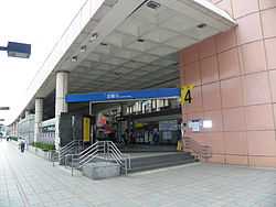
| Kunyang Station Exit 4 | |
| Location | |
| Municipality | Taipei |
| District(s) | Nangang |
| Address | No. 451, Sec. 6, Zhongxiao E. Rd. |
| Info | |
| Type | Underground |
| History | |
| Opened | December 30, 2000 |
| Rail services | |
| Line(s) | Nangang Line (BL16) |
| Daily Ridership | 32,808 (2011)[1] (Ranked 36th of 89) |
| Operator(s) | Taipei Rapid Transit System |
| Kunyang Station | |||||||||
| Traditional Chinese | 昆陽站 | ||||||||
|---|---|---|---|---|---|---|---|---|---|
| Simplified Chinese | 昆阳站 | ||||||||
| |||||||||
The Taipei Metro Kunyang Station is a station on the Nangang Line (Blue Line) located in Nangang District, Taipei, Taiwan.[2]
Station overview
The station is a two-level, underground station with an island platform and four exits. It is located beneath Zhongxiao East Rd.
Public art for the station is titled "Around" and is composed of carousel horses that dance to music whenever the viewer comes near. They are located along the glass windows of the concourse level.[3]
Station layout
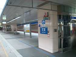
Kunyang Station platform
| L1 | Concourse | Exit/ Entrance, lobby, information desk, automatic ticket dispensing machines, one-way faregates, Restrooms(inside ticketed area) |
| B1 | Platform 1 | ← Nangang Line toward Taipei Nangang Exhibition Center (Nangang) |
| Platform 2 | → Nangang Line toward Yongning/ Far Eastern Hospital (Houshanpi) → | |
Exits
- Exit 1: Combined Logistics Command Headquarters
- Exit 2: Lane 403, Zhongxiao Rd. Sec.6
- Exit 3: Nangang Senior High School
- Exit 4: Kunyang St.

Around the station
- Taipei Metro Nangang Depot
- Ministry of National Defense
- Ministry of Health and Welfare
- Nangang High School
- Chengde Elementary School (between this station and Houshanpi Station)
- Nangang Park
| Preceding station | Taipei Metro | Following station | ||
|---|---|---|---|---|
toward Yongning | Blue Line Nangang Line | toward Taipei Nangang Exhibition Center |
References
| Wikimedia Commons has media related to Kunyang Station. |
- ↑ "Passenger Volume at Taipei Rapid Transit Stations" (PDF). Taipei City Department of Transportation. 2012-01-20. Retrieved 2012-02-05.
- ↑ "Route Map: Kunyang".
- ↑ "Public Art on the Nangang Line". Department of Rapid Transit Systems. Retrieved 2010-12-09.
Coordinates: 25°03′02″N 121°35′36″E / 25.050492°N 121.593276°E