Kuntur Chukuña (Oruro)
| Kuntur Chukuña | |
|---|---|
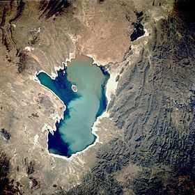 Poopó Lake from above. Kuntur Chukuña lies in the mountainous complex south-east of it (lower center,
left). | |
| Elevation | 4,035 m (13,238 ft)[1] |
| Location | |
 Kuntur Chukuña | |
| Range | Andes |
| Coordinates | 19°15′S 66°43′W / 19.250°S 66.717°WCoordinates: 19°15′S 66°43′W / 19.250°S 66.717°W[2] |
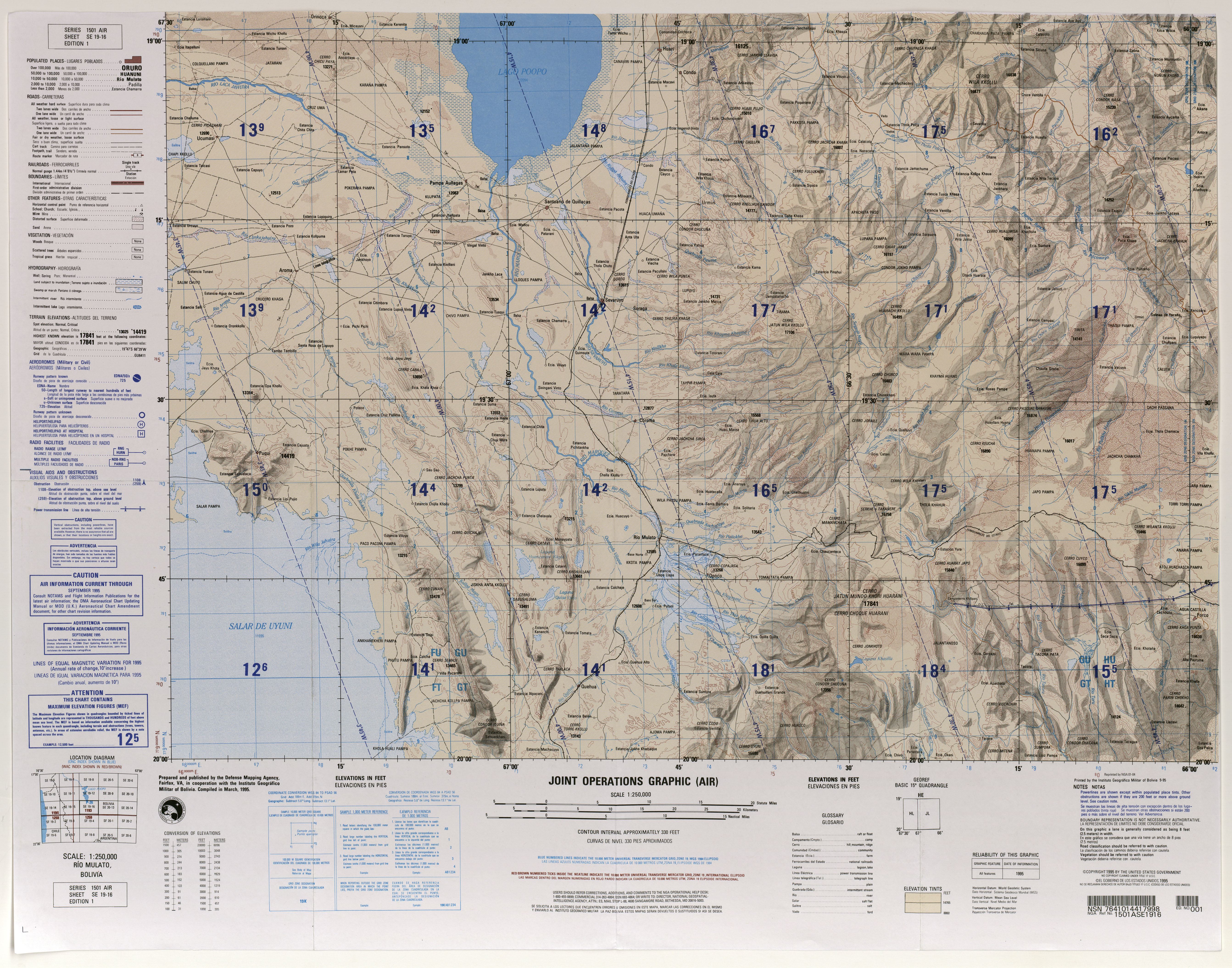
Kuntur Chukuña (Aymara kunturi condor,[3] Aymara chukuña to squat, to cower,[4] 'where the condor squats', hispanicized spellings Condor Chucuna, Condor Chucuña) is a mountain in the Andes of Bolivia, about 4,035 metres (13,238 ft) high. It is situated in the Oruro Department, Sebastián Pagador Province (which is identical to the Santiago de Huari Municipality), Lukumpaya Canton.[5][6] It lies south-east of Poopó Lake, south of the village Urmiri and north-west of the mountain Jatun Wila Qullu.
See also
References
- ↑ own investigation (GE)
- ↑ own investigation (GE)
- ↑ Yatiqirinaka Aru Pirwa, Lima, 2005 (Aymara-Spanish dictionary)
- ↑ Juan Carvajal Carvajal, Arturo Hernández Sallés, Nelly Ramos Pizarro, Diccionario Ilustrado Aymara-Español-Inglés (Aymara-Spanish-English dictionary)
- ↑ lib.utexas.edu Map showing Kuntur Chukuña ("Condor Chucuña") south of Urmiri
- ↑ Tomave Municipality: population data and map