Kryoneri, Attica
Kryoneri (Greek: Κρυονέρι, meaning "cold water") is a suburban town of East Attica, Greece. Since the 2011 local government reform it is part of the municipality Dionysos, of which it is a municipal unit.[2]
Geography
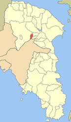
Kryoneri is situated in the hills in the northeastern part of the Athens conurbation, at about 380 m elevation. It lies in the eastern foothills of the Parnitha mountains. It is 2 km west of Agios Stefanos and 20 km northeast of Athens city centre. Motorway 1 (Athens - Lamia - Thessaloniki) and the railway from Athens to Thessaloniki pass east of the town.
Historical population
| Year | Population |
|---|
| 1981 | 858 |
| 1991 | 1,261 |
| 2001 | 2,721 |
| 2011 | 5,040 |
Notes
External links
Subdivisions of the municipality of Dionysos |
|---|
| | Municipal units | |
|---|
|