Kremmen
For the comedy science fiction character, see Captain Kremmen.
| Kremmen | ||
|---|---|---|
|
Manor in Beetz | ||
| ||
 Kremmen | ||
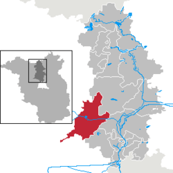
Location of Kremmen within Oberhavel district  | ||
| Coordinates: 52°46′00″N 13°01′59″E / 52.76667°N 13.03306°ECoordinates: 52°46′00″N 13°01′59″E / 52.76667°N 13.03306°E | ||
| Country | Germany | |
| State | Brandenburg | |
| District | Oberhavel | |
| Government | ||
| • Mayor | Klaus-Jürgen Sasse | |
| Area | ||
| • Total | 208.43 km2 (80.48 sq mi) | |
| Population (2012-12-31)[1] | ||
| • Total | 7,115 | |
| • Density | 34/km2 (88/sq mi) | |
| Time zone | CET/CEST (UTC+1/+2) | |
| Postal codes | 16766 | |
| Dialling codes | 033055 | |
| Vehicle registration | OHV | |
| Website | www.kremmen.de | |

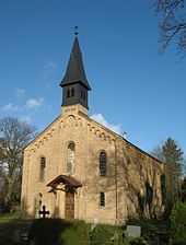
Church in Hohenbruch

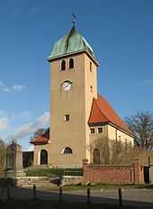
Church in Sommerfeld
Kremmen is a town in the district of Oberhavel, in Brandenburg, Germany. It is located 15 km west of Oranienburg and 38 km northwest of Berlin. It is known mostly for its castle Ziethen. The local church contains an organ built in 1817 by Tobias Thurley.
Demography
-

Development of Population since 1875 within the Current Boundaries (Blue Line: Population; Dotted Line: Comparison to Population Development of Brandenburg state; Grey Background: Time of Nazi rule; Red Background: Time of Communist rule)
-

Recent Population Development (Blue Line) and Forecasts
|
|
|
|
Detailed data sources are to be found in the Wikimedia Commons.[3]
Photogallery
- Clinic buildings „Waldhaus Charlottenburg“ in Kremmen-Sommerfeld
-

-

-

-

-

-

References

Church in Flatow

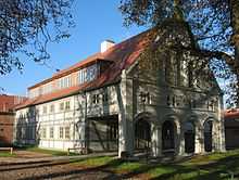
Alcove house in Staffelde
- ↑ "Bevölkerung im Land Brandenburg nach amtsfreien Gemeinden, Ämtern und Gemeinden 31. Dezember 2012 (XLS-Datei; 83 KB) (Einwohnerzahlen auf Grundlage des Zensus 2011)". Amt für Statistik Berlin-Brandenburg (in German). 31 December 2012.
- ↑ Boundaries as of 2013
- ↑ Population Projection Brandenburg at Wikimedia Commons
External links
![]() Media related to Kremmen at Wikimedia Commons
Media related to Kremmen at Wikimedia Commons
- (German) Tag des offenen Denkmals
| ||||||||

