Krasnogvardeysky District, Republic of Adygea
| Krasnogvardeysky District Красногвардейский район (Russian) Красногвардейскэ район (Adyghe) | |
|---|---|
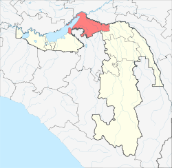 Location of Krasnogvardeysky District in the Republic of Adygea | |
| Coordinates: 45°07′N 39°34′E / 45.117°N 39.567°ECoordinates: 45°07′N 39°34′E / 45.117°N 39.567°E | |
 | |
|
| |
| Location | |
| Country | Russia |
| Federal subject | Republic of Adygea[1] |
| Administrative structure (as of June 2012) | |
| Administrative center | selo of Krasnogvardeyskoye[1] |
| Inhabited localities: | |
| Rural localities | 25 |
| Municipal structure (as of May 2005) | |
| Municipally incorporated as | Krasnogvardeysky Municipal District[2] |
| Municipal divisions:[2] | |
| Urban settlements | 0 |
| Rural settlements | 7 |
| Local government: | |
| Head | Vyacheslav Tkhitlyanov |
| Statistics | |
| Area | 725.5 km2 (280.1 sq mi) |
| Population (2010 Census) | 30,868 inhabitants[3] |
| - Urban | 0% |
| - Rural | 100% |
| Density | 42.55/km2 (110.2/sq mi)[4] |
| Time zone | MSK (UTC+03:00)[5] |
| Established | February 7, 1929[6] |
| Official website | |
| Krasnogvardeysky District on WikiCommons | |
Krasnogvardeysky District (Russian: Красногварде́йский райо́н; Adyghe: Красногвардейскэ район) is an administrative[1] and a municipal[2] district (raion), one of the seven in the Republic of Adygea, Russia. It is located in the northwest of the republic and borders with Ust-Labinsky District of Krasnodar Krai in the north, Shovgenovsky District in the east, Belorechensky District of Krasnodar Krai in the south, and with Krasnodar Reservoir in the west. Its borders with Teuchezhsky District (in the west) and Dinskoy District of Krasnodar Krai (in the northwest) pass through the waters of Krasnodar Reservoir. The area of the district is 725.5 square kilometers (280.1 sq mi). Its administrative center is the rural locality (a selo) of Krasnogvardeyskoye.[1] District's population: 30,868 (2010 Census);[3] 31,536 (2002 Census);[7] 29,953 (1989 Census).[8]. The population of Krasnogvardeyskoye accounts for 30.6% of the district's total population.[3]
History
The district was established on February 7, 1929.[6] It was transformed into a rural district on February 1, 1963, but this was reversed on January 12, 1965.[6]
Divisions
Administrative divisions
Krasnogvardeysky District has administrative jurisdiction over all of its twenty-five rural localities.
Municipal divisions
Municipally, the district is divided into seven rural settlements:[2]
- Beloselskoye (Белосельское)
- Bolshesidorovskoye (Большесидоровское)
- Administrative center: selo of Bolshesidorovskoye
- other localities of the rural settlement:
- aul of Dzhambechi
- Khatukayskoye (Хатукайское)
- Administrative center: aul of Khatukay
- other localities of the rural settlement:
- settlement of Lesnoy
- settlement of Naberezhny
- settlement of Svobodny
- settlement of Vodny
- Krasnogvardeyskoye (Красногвардейское)
- Administrative center: selo of Krasnogvardeyskoye
- other localities of the rural settlement:
- aul of Adamiy
- khutor of Chumakov
- Sadovoye (Садовое)
- Administrative center: selo of Sadovoye
- other localities of the rural settlement:
- aul of Bzhedugkhabl
- selo of Verkhnenazarovskoye
- Ulyapskoye (Уляпское)
- Administrative center: aul of Ulyap
- other localities of the rural settlement:
- selo of Shturbino
- Yelenovskoye (Еленовское)
- Administrative center: selo of Yelenovskoye
- other localities of the rural settlement:
- khutor of Doguzhiyev
- khutor of Pustoselov
- khutor of Saratovsky
References
Notes
- ↑ 1.0 1.1 1.2 1.3 Law #171
- ↑ 2.0 2.1 2.2 2.3 Law #281
- ↑ 3.0 3.1 3.2 Russian Federal State Statistics Service (2011). "Всероссийская перепись населения 2010 года. Том 1" [2010 All-Russian Population Census, vol. 1]. Всероссийская перепись населения 2010 года (2010 All-Russia Population Census) (in Russian). Federal State Statistics Service. Retrieved June 29, 2012.
- ↑ The value of density was calculated automatically by dividing the 2010 Census population by the area specified in the infobox. Please note that this value may not be accurate as the area specified in the infobox does not necessarily correspond to the area of the entity proper or is reported for the same year as the population.
- ↑ Правительство Российской Федерации. Федеральный закон №107-ФЗ от 3 июня 2011 г. «Об исчислении времени», в ред. Федерального закона №248-ФЗ от 21 июля 2014 г. «О внесении изменений в Федеральный закон "Об исчислении времени"». Вступил в силу по истечении шестидесяти дней после дня официального опубликования (6 августа 2011 г.). Опубликован: "Российская газета", №120, 6 июня 2011 г. (Government of the Russian Federation. Federal Law #107-FZ of June 31, 2011 On Calculating Time, as amended by the Federal Law #248-FZ of July 21, 2014 On Amending Federal Law "On Calculating Time". Effective as of after sixty days following the day of the official publication.).
- ↑ 6.0 6.1 6.2 Азаренкова, А. С.; И. Ю. Бондарь, Н. С. Вертышева (1986) [1986]. Основные административно-территориальные преобразования на Кубани (1793–1985 гг.) (in Russian). Краснодарское книжное издательство. p. 180.
- ↑ Russian Federal State Statistics Service (May 21, 2004). "Численность населения России, субъектов Российской Федерации в составе федеральных округов, районов, городских поселений, сельских населённых пунктов – районных центров и сельских населённых пунктов с населением 3 тысячи и более человек" [Population of Russia, Its Federal Districts, Federal Subjects, Districts, Urban Localities, Rural Localities—Administrative Centers, and Rural Localities with Population of Over 3,000] (XLS). Всероссийская перепись населения 2002 года [All-Russia Population Census of 2002] (in Russian). Retrieved August 9, 2014.
- ↑ Demoscope Weekly (1989). "Всесоюзная перепись населения 1989 г. Численность наличного населения союзных и автономных республик, автономных областей и округов, краёв, областей, районов, городских поселений и сёл-райцентров" [All Union Population Census of 1989: Present Population of Union and Autonomous Republics, Autonomous Oblasts and Okrugs, Krais, Oblasts, Districts, Urban Settlements, and Villages Serving as District Administrative Centers]. Всесоюзная перепись населения 1989 года[All-Union Population Census of 1989] (in Russian). Институт демографии Национального исследовательского университета: Высшая школа экономики [Institute of Demography at the National Research University: Higher School of Economics]. Retrieved August 9, 2014.
Sources
- Государственный Совет — Хасэ Республики Адыгея. Закон №171 от 5 мая 2000 г. «Об административно-территориальном устройстве Республики Адыгея», в ред. Закона №97 от 6 июня 2012 г. «О внесении изменений в некоторые Законы Республики Адыгея в связи с принятием Закона Республики Адыгея "Об отнесении посёлка городского типа Тульского к категории посёлков — сельских населённых пунктов"». Вступил в силу со дня официального опубликования. Опубликован: "Советская Адыгея", №156-157, 7 августа 2004 г. (State Assembly of the Republic of Adygea. Law #171 of May 5, 2000 On the Administrative-Territorial Structure of the Republic of Adygea, as amended by the Law #97 of June 6, 2012 On Amending Various Laws of the Republic of Adygea Due to the Adoption of the Law of the Republic of Adygea "On Transformation of the Urban-Type Settlement of Tulsky into a Settlement—a Rural Locality. Effective as of the official publication date.).
- Совет Республики Адыгея. Закон №281 от 30 декабря 2004 г. «О наделении муниципального образования "Красногвардейский район" статусом муниципального района, об образовании муниципальных образований в его составе и установлении их границ», в ред. Закона №176 от 4 апреля 2013 г. «О внесении изменений в Закон Республики Адыгея "О наделении муниципального образования "Красногвардейский район" статусом муниципального района, об образовании муниципальных образований в его составе и установлении их границ"». Вступил в силу со дня официального опубликования. Опубликован: "Советская Адыгея", №2–5, 12 января 2005 г. (Council of the Republic of Adygea. Law #281 of December 30, 2004 On Granting the Municipal Formation of "Krasnogvardeysky District" the Status of a Municipal District, on Establishing the Municipal Formations Within It, and on Establishing Their Borders, as amended by the Law #176 of April 4, 2013 On Amending the Law of the Republic of Adygea "On Granting the Municipal Formation of "Krasnogvardeysky District" the Status of a Municipal District, on Establishing the Municipal Formations Within It, and on Establishing Their Borders". Effective as of the day of the official publication.).
| ||||||||||||||||||||||||