Kralkızı Dam
| Kralkızı Dam |
|---|
|
|
|
Location of Kralkızı Dam |
| Official name |
Kralkızı Baraji |
|---|
| Location |
Diyarbakır, Turkey |
|---|
| Coordinates |
38°20′57″N 40°01′15″E / 38.34917°N 40.02083°E / 38.34917; 40.02083Coordinates: 38°20′57″N 40°01′15″E / 38.34917°N 40.02083°E / 38.34917; 40.02083 |
|---|
| Purpose |
Power |
|---|
| Status |
Operational |
|---|
| Construction began |
1985 |
|---|
| Opening date |
1997 |
|---|
| Owner(s) |
State Hydraulic Works |
|---|
| Dam and spillways |
|---|
| Type of dam |
Embankment, rock-fill |
|---|
| Impounds |
Maden River |
|---|
| Height |
113 m (371 ft) |
|---|
| Length |
1,030 m (3,379 ft) |
|---|
| Elevation at crest |
819 m (2,687 ft) |
|---|
| Width (crest) |
12 m (39 ft) |
|---|
| Width (base) |
550 m (1,804 ft) |
|---|
| Dam volume |
14,500,000 m3 (11,755 acre·ft) |
|---|
| Spillway type |
Service overflow, controlled-chute |
|---|
| Spillway capacity |
2,300 m3/s (81,224 cu ft/s) |
|---|
| Reservoir |
|---|
| Creates |
Kralkızı Reservoir |
|---|
| Total capacity |
1,919,000,000 m3 (1,556,000 acre·ft) |
|---|
| Active capacity |
1,711,000,000 m3 (1,387,000 acre·ft) |
|---|
| Inactive capacity |
208,000,000 m3 (169,000 acre·ft) |
|---|
| Catchment area |
1,300 km2 (502 sq mi) |
|---|
| Surface area |
58 km2 (22 sq mi)[1] |
|---|
| Max. length |
26 km (16 mi) |
|---|
| Normal elevation |
815.75 m (2,676.3 ft) |
|---|
| Power station |
|---|
| Hydraulic head |
71 m (233 ft) (gross) |
|---|
| Turbines |
3 x 47 MW Francis-type |
|---|
| Installed capacity |
94 MW |
|---|
| Annual generation |
146 GWh |
|---|
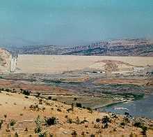
Kralkızı Dam is one of the 21 dams of the Southeastern Anatolia Project of Turkey in Batman. The hydroelectric power plant has a total installed power capacity of 94 MW. The dam was constructed between 1985 and 1997.
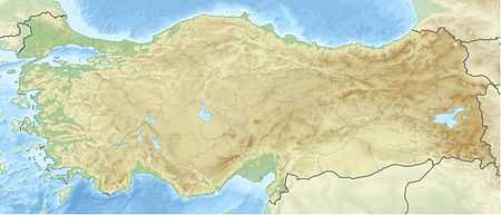
These facilities are located on the Maden Stream, one of the important tributaries of the Tigris River, at a distance of 81 kilometres to Diyarbakır and 6 kilometres to the township of Dicle.[2]
Notes
References
External links

