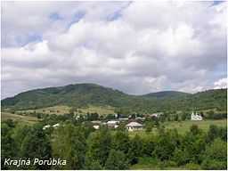
Krajná Porúbka
| Krajná Porúbka | |
| Village | |
 | |
| Country | Slovakia |
|---|---|
| Region | Prešov |
| District | Svidník |
| Elevation | 420 m (1,378 ft) |
| Coordinates | 49°24′N 21°39′E / 49.400°N 21.650°ECoordinates: 49°24′N 21°39′E / 49.400°N 21.650°E |
| Area | 3.727 km2 (1.44 sq mi) |
| Population | 56 (2004-12-31) |
| Density | 15 / km2 (39 / sq mi) |
| First mentioned | 1582 |
| Postal code | 090 05 |
| Area code | +421-54 |
| Car plate | SK |
  Location of Krajná Porúbka in Slovakia
| |
_-_background_map.png) _-_outline_map.svg.png) Location of Krajná Porúbka in the Eastern part of the Prešov Region
| |
| Statistics: MOŠ/MIS | |
Krajná Porúbka is a village and municipality in Svidník District in the Prešov Region of north-eastern Slovakia.
History
In historical records the village was first mentioned in 1582.
Geography
The municipality lies at an altitude of 420 metres and covers an area of 3.728 km2 (1.44 sq mi). It has a population of about 56 people.
Genealogical resources
The records for genealogical research are available at the state archive "Statny Archiv in Presov, Slovakia"
- Greek Catholic church records (births/marriages/deaths): 1787-1950 (parish B)