Koyuk Alfred Adams Airport
| Koyuk Alfred Adams Airport | |||||||||||
|---|---|---|---|---|---|---|---|---|---|---|---|
| IATA: KKA – ICAO: PAKK – FAA LID: KKA | |||||||||||
| Summary | |||||||||||
| Airport type | Public | ||||||||||
| Owner | State of Alaska DOT&PF - Northern Region | ||||||||||
| Serves | Koyuk, Alaska | ||||||||||
| Elevation AMSL | 154 ft / 47 m | ||||||||||
| Coordinates | 64°56′22″N 161°09′15″W / 64.93944°N 161.15417°W | ||||||||||
| Runways | |||||||||||
| |||||||||||
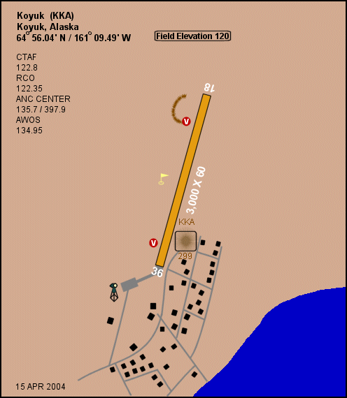
Koyuk Alfred Adams Airport (IATA: KKA, ICAO: PAKK, FAA LID: KKA) is a state-owned public-use airport located in Koyuk, a city in the Nome Census Area of the U.S. state of Alaska.[1]
Facilities
Koyuk Alfred Adams Airport covers an area of 132 acres (53 ha) which contains one runway designated 1/19 with a 3,000 x 60 ft (914 x 18 m) gravel surface.[1]
Airlines and non-stop destinations
| Airlines | Destinations |
|---|---|
| PenAir | Elim, Golovin, Koyuk, Nome, Unalakleet, White Mountain[2] |
| PenAir | Elim, Nome[3] |
| PenAir | Unalakleet[4] |
References
- ↑ 1.0 1.1 1.2 FAA Airport Master Record for KKA (Form 5010 PDF), effective 2007-07-05
- ↑ Bering Air: Nome Flight Schedule (PDF). Retrieved 31-Aug-2007.
- ↑ Frontier Flying Service: 2007 Timetable (PDF). Retrieved 31-Aug-2007.
- ↑ Hageland Aviation Services: Scheduled Flights (PDF). Retrieved 31-Aug-2007.
External links
- FAA Alaska airport diagram (GIF)
- FAA Terminal Procedures for KKA, effective April 2, 2015
- Resources for this airport:
- FAA airport information for KKA
- AirNav airport information for PAKK
- ASN accident history for KKA
- FlightAware airport information and live flight tracker
- NOAA/NWS latest weather observations for PAKK
- SkyVector aeronautical chart for KKA