Koyra Upazila
| Koyra কয়রা | |
|---|---|
| Upazila | |
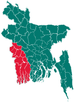
 Koyra Location in Bangladesh | |
| Coordinates: 22°20.5′N 89°18′E / 22.3417°N 89.300°ECoordinates: 22°20.5′N 89°18′E / 22.3417°N 89.300°E | |
| Country |
|
| Division | Khulna Division |
| District | Khulna District |
| Area | |
| • Total | 1,775.41 km2 (685.49 sq mi) |
| Population (1991) | |
| • Total | 165,473 |
| • Density | 93/km2 (240/sq mi) |
| Time zone | BST (UTC+6) |
| Website | |
Koyra (Bengali: কয়রা) is an Upazila of Khulna District in the Division of Khulna, Bangladesh.
Geography
Koyra is located at 22°20′30″N 89°18′00″E / 22.3417°N 89.3000°E. It has 28,061 households and a total area 1775.41 km².
Demographics
According to the 1991 Bangladesh census, Koyra had a population of 165,473. Males constituted 49.68% of the population, and females 50.32%. The population aged 18 or over was 80,830. Koyra had an average literacy rate of 32.4% (7+ years), compared to the national average of 32.4%.[1]
Administration
Koyra has 7 Unions/Wards, 72 Mauzas/Mahallas, and 131 villages. The Unions are:
- Bagali
- Moheswaripur
- Moharajpur
- Koyra
- Uttor Betkashi
- Daskin Betkashi
- Amadi
Educational institutions
Primary schools
- Koyra Govt. Primary School
- Borobari Govt. Primary School
Secondary schools
- Koyra Madinabad High School
- Bedkahsi High School
- Maheswaripur High School
Colleges
- Kapotakhma College
- Jobeda Khanam Mahila College
Transport
See also
References
- ↑ "Population Census Wing, BBS.". Archived from the original on 2005-03-27. Retrieved November 10, 2006.
| ||||||||