Kosino-Ukhtomsky District
| Kosino-Ukhtomsky District Косино-Ухтомский (Russian) | |
|---|---|
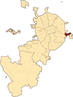
 Location of Kosino-Ukhtomsky District on the map of Moscow | |
.png) |
.png) |
|
| |
| Location | |
| Country | Russia |
| Federal subject | Moscow |
| Statistics | |
| Time zone | MSK (UTC+03:00)[1] |
| Kosino-Ukhtomsky District on WikiCommons | |
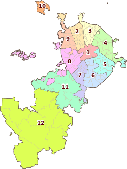
Kosino-Ukhtomsky District is an administrative district (raion) of Eastern Administrative Okrug, and one of the 125 raions of Moscow, Russia.[2]
Moscow Districts in Eastern Administrative Okrug city Moscow and the same name Municipalities Moscow intracity municipal unions. Borders on the Veshnyaki, Vykhino-Zhulebino, Novokosino and Nekrasovka, as well as city Lyubertsy. The area of the district is 1506 hectares.[3]
District Kosino Ukhtomsky consists of three districts - Kozhukhovo, Kosino Kosino and Ukhtomsky. Population - 16,917.
History
According to archaeological evidence, people lived in this area for a very long time. On the territory of Kosino and its surroundings at the end of the last century were discovered 4 groups mound s (of 15 mounds) and 2 Neolithic sites. People are so-called Abashevskaya archaeological culture Bronze Age lived here more in the 2nd millennium BC. & Nbsp; e. Three groups of mounds located between the White and holy lakes, excavated, and one group - near Zhulebino - still waiting for the excavation. Kosinski found in barrows items are in the Museum of Anthropology Moscow State University.
See also
References
Notes
- ↑ Правительство Российской Федерации. Федеральный закон №107-ФЗ от 3 июня 2011 г. «Об исчислении времени», в ред. Федерального закона №248-ФЗ от 21 июля 2014 г. «О внесении изменений в Федеральный закон "Об исчислении времени"». Вступил в силу по истечении шестидесяти дней после дня официального опубликования (6 августа 2011 г.). Опубликован: "Российская газета", №120, 6 июня 2011 г. (Government of the Russian Federation. Federal Law #107-FZ of June 31, 2011 On Calculating Time, as amended by the Federal Law #248-FZ of July 21, 2014 On Amending Federal Law "On Calculating Time". Effective as of after sixty days following the day of the official publication.).
- ↑ Государственный комитет Российской Федерации по статистике. Комитет Российской Федерации по стандартизации, метрологии и сертификации. №ОК 019-95 1 января 1997 г. «Общероссийский классификатор объектов административно-территориального деления. Код 45», в ред. изменения №243/2014 от 18 апреля 2014 г.. (State Statistics Committee of the Russian Federation. Committee of the Russian Federation on Standardization, Metrology, and Certification. #OK 019-95 January 1, 1997 Russian Classification of Objects of Administrative Division . Code 45, as amended by the Amendment #243/2014 of April 18, 2014. ).
- ↑
Sources
| ||||||||||||||||||||||||||||||||||||||||||||||||||||
Coordinates: 55°42′53″N 37°53′34″E / 55.71472°N 37.89278°E
