Koshekhablsky District
| Koshekhablsky District Кошехабльский район (Russian) Кощхьаблэ район (Adyghe) | |
|---|---|
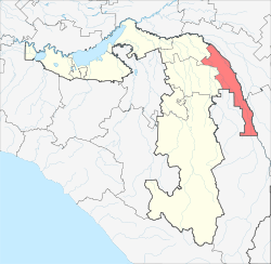 Location of Koshekhablsky District in the Republic of Adygea | |
| Coordinates: 44°54′N 40°29′E / 44.900°N 40.483°ECoordinates: 44°54′N 40°29′E / 44.900°N 40.483°E | |
 | |
|
| |
| Location | |
| Country | Russia |
| Federal subject | Republic of Adygea[1] |
| Administrative structure (as of June 2012) | |
| Administrative center | aul of Koshekhabl[1] |
| Inhabited localities: | |
| Rural localities | 24 |
| Municipal structure (as of December 2004) | |
| Municipally incorporated as | Koshekhablsky Municipal District[2] |
| Municipal divisions:[2] | |
| Urban settlements | 0 |
| Rural settlements | 9 |
| Local government: | |
| Head | Nalby Tkharkakhov |
| Statistics | |
| Area | 606.7 km2 (234.2 sq mi)[3] |
| Population (2010 Census) | 30,422 inhabitants[4] |
| - Urban | 0% |
| - Rural | 100% |
| Density | 50.14/km2 (129.9/sq mi)[5] |
| Time zone | MSK (UTC+03:00)[6] |
| Established |
December 31, 1934 (first),[7] January 12, 1965 (second)[7] |
| Official website | |
| Koshekhablsky District on WikiCommons | |
Koshekhablsky District (Russian: Кошеха́бльский райо́н; Adyghe: Кощхьэблэ район) is an administrative[1] and a municipal[2] district (raion), one of the seven in the Republic of Adygea, Russia. It is located in the east of the republic and borders with Kurganinsky District of Krasnodar Krai in the north and northeast, Labinsky District of Krasnodar Krai in the east, Mostovsky District of Krasnodar Krai in the south, Maykopsky District in the west, and with Shovgenovsky District in the northwest. The area of the district is 606.7 square kilometers (234.2 sq mi).[3] Its administrative center is the rural locality (an aul) of Koshekhabl.[1] Population: 30,422 (2010 Census);[4] 31,296 (2002 Census);[8] 29,766 (1989 Census).[9] The population of Koshekhabl accounts for 23.8% of the district's total population.[4]
Etymology
The name "Koshekhablsky" is derived from the Circassian words "Kosho" (a Shapsug family name) and "Habl" (meaning neighborhood).
History
Koshekhablsky District was established within Azov-Black Sea Krai on December 31, 1934[7] as a result of the downsizing of the krai's districts. On December 7, 1956, the district was enlarged as portions of abolished Shovgenovsky District were merged into it. However, as the enlargement policy did not prove effective, the district was restored in its previous borders on March 21, 1958. On February 1, 1963, Koshekhablsky District was abolished[7] and merged into newly created Shovgenovsky Rural District. As the new system of rural districts turned out to be inefficient as well, Koshekhablsky District was re-instated in its pre-1963 borders on January 12, 1965.[7]
Divisions
Administrative divisions
Koshekhablsky District has administrative jurisdiction over all of its twenty-four rural localities.
Municipal divisions
Municipally, the district is divided into nine rural settlements:[2]
- Blechepsinskoye (Блечепсинское)
- Administrative center: aul of Blechepsin
- Dmitriyevskoye (Дмитриевское)
- Administrative center: settlement of Druzhba
- other localities of the rural settlement:
- settlement of Chekhrak, Dmitriyevskoye Rural Settlement
- khutor of Dmitriyevsky
- aul of Khachemziy
- settlement of Komsomolsky
- khutor of Krasny Fars
- khutor of Novoalexeyevsky
- khutor of Otradny
- settlement of Plodopitomnik
- khutor of Politotdel
- Ignatyevskoye (Игнатьевское)
- Administrative center: khutor of Ignatyevsky
- Khodzinskoye (Ходзинское)
- Administrative center: aul of Khodz
- Koshekhablskoye (Кошехабльское)
- Administrative center: aul of Koshekhabl
- Mayskoye (Майское)
- Administrative center: settlement of Maysky
- other localities of the rural settlement:
- khutor of Chekhrak, Mayskoye Rural Settlement
- khutor of Krasny
- Natyrbovskoye (Натырбовское)
- Administrative center: selo of Natyrbovo
- other localities of the rural settlement:
- khutor of Kazyonno-Kuzhorsky
- Volnenskoye (Вольненское)
- Administrative center: selo of Volnoye
- other localities of the rural settlement:
- khutor of Karmolino-Gidroitsky
- khutor of Shelkovnikov
- Yegerukhayskoye (Егерухайское)
- Administrative center: aul of Yegerukhay
- other localities of the rural settlement:
- khutor of Sokolov
References
Notes
- ↑ 1.0 1.1 1.2 1.3 Law #171
- ↑ 2.0 2.1 2.2 2.3 Law #282
- ↑ 3.0 3.1 Газета "Карелия", №53 (569), 15 сентября 1999 г. "Далёкая и близкая Адыгея" (Russian)
- ↑ 4.0 4.1 4.2 Russian Federal State Statistics Service (2011). "Всероссийская перепись населения 2010 года. Том 1" [2010 All-Russian Population Census, vol. 1]. Всероссийская перепись населения 2010 года (2010 All-Russia Population Census) (in Russian). Federal State Statistics Service. Retrieved June 29, 2012.
- ↑ The value of density was calculated automatically by dividing the 2010 Census population by the area specified in the infobox. Please note that this value may not be accurate as the area specified in the infobox does not necessarily correspond to the area of the entity proper or is reported for the same year as the population.
- ↑ Правительство Российской Федерации. Федеральный закон №107-ФЗ от 3 июня 2011 г. «Об исчислении времени», в ред. Федерального закона №248-ФЗ от 21 июля 2014 г. «О внесении изменений в Федеральный закон "Об исчислении времени"». Вступил в силу по истечении шестидесяти дней после дня официального опубликования (6 августа 2011 г.). Опубликован: "Российская газета", №120, 6 июня 2011 г. (Government of the Russian Federation. Federal Law #107-FZ of June 31, 2011 On Calculating Time, as amended by the Federal Law #248-FZ of July 21, 2014 On Amending Federal Law "On Calculating Time". Effective as of after sixty days following the day of the official publication.).
- ↑ 7.0 7.1 7.2 7.3 7.4 Азаренкова, А. С.; И. Ю. Бондарь, Н. С. Вертышева (1986) [1986]. Основные административно-территориальные преобразования на Кубани (1793–1985 гг.) (in Russian). Краснодарское книжное издательство. p. 180.
- ↑ Russian Federal State Statistics Service (May 21, 2004). "Численность населения России, субъектов Российской Федерации в составе федеральных округов, районов, городских поселений, сельских населённых пунктов – районных центров и сельских населённых пунктов с населением 3 тысячи и более человек" [Population of Russia, Its Federal Districts, Federal Subjects, Districts, Urban Localities, Rural Localities—Administrative Centers, and Rural Localities with Population of Over 3,000] (XLS). Всероссийская перепись населения 2002 года [All-Russia Population Census of 2002] (in Russian). Retrieved August 9, 2014.
- ↑ Demoscope Weekly (1989). "Всесоюзная перепись населения 1989 г. Численность наличного населения союзных и автономных республик, автономных областей и округов, краёв, областей, районов, городских поселений и сёл-райцентров" [All Union Population Census of 1989: Present Population of Union and Autonomous Republics, Autonomous Oblasts and Okrugs, Krais, Oblasts, Districts, Urban Settlements, and Villages Serving as District Administrative Centers]. Всесоюзная перепись населения 1989 года[All-Union Population Census of 1989] (in Russian). Институт демографии Национального исследовательского университета: Высшая школа экономики [Institute of Demography at the National Research University: Higher School of Economics]. Retrieved August 9, 2014.
Sources
- Государственный Совет — Хасэ Республики Адыгея. Закон №171 от 5 мая 2000 г. «Об административно-территориальном устройстве Республики Адыгея», в ред. Закона №97 от 6 июня 2012 г. «О внесении изменений в некоторые Законы Республики Адыгея в связи с принятием Закона Республики Адыгея "Об отнесении посёлка городского типа Тульского к категории посёлков — сельских населённых пунктов"». Вступил в силу со дня официального опубликования. Опубликован: "Советская Адыгея", №156-157, 7 августа 2004 г. (State Assembly of the Republic of Adygea. Law #171 of May 5, 2000 On the Administrative-Territorial Structure of the Republic of Adygea, as amended by the Law #97 of June 6, 2012 On Amending Various Laws of the Republic of Adygea Due to the Adoption of the Law of the Republic of Adygea "On Transformation of the Urban-Type Settlement of Tulsky into a Settlement—a Rural Locality. Effective as of the official publication date.).
- Совет Республики Адыгея. Закон №282 от 30 декабря 2004 г. «О наделении муниципального образования "Кошехабльский район" статусом муниципального района, об образовании муниципальных образований в его составе и установлении их границ», в ред. Закона №377 от 30 декабря 2014 г. «О внесении изменений в Закон Республики Адыгея "О наделении муниципального образования "Кошехабльский район" статусом муниципального района, об образовании муниципальных образований в его составе и установлении их границ"». Вступил в силу со дня официального опубликования. Опубликован: "Советская Адыгея", №2–5, 12 января 2005 г. (Council of the Republic of Adygea. Law #282 of December 30, 2004 On Granting Municipal District Status to the Municipal Formation of "Koshekhablsky District", on Establishing Municipal Formations Within Its Structure, and on Establishing Their Borders, as amended by the Law #377 of December 30, 2014 On Amending the Law of the Repulic of Adygea "On Granting Municipal District Status to the Municipal Formation of "Koshekhablsky District", on Establishing Municipal Formations Within Its Structure, and on Establishing Their Borders". Effective as of the day of the official publication.).
| ||||||||||||||||||||||||