Kopivnik
| Kopivnik | |
|---|---|
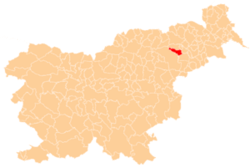
_location_map.svg.png) Kopivnik Location in Slovenia | |
| Coordinates: 46°27′33.48″N 15°36′32.99″E / 46.4593000°N 15.6091639°ECoordinates: 46°27′33.48″N 15°36′32.99″E / 46.4593000°N 15.6091639°E | |
| Country |
|
| Traditional region | Lower Styria |
| Statistical region | Drava |
| Municipality | Rače-Fram |
| Area | |
| • Total | 2.42 km2 (0.93 sq mi) |
| Elevation | 481.5 m (1,579.7 ft) |
| Population (2002) | |
| • Total | 191 |
| [1] | |
Kopivnik is a settlement in the Rače-Fram municipality in northeastern Slovenia. It lies on the eastern edge of the Pohorje hills, above Fram. The area is part of the traditional region of Lower Styria. The municipality is now included in the Drava statistical region.[2]
References
External links
| ||||||||||||||||||