Koolkerke
| Koolkerke | |
|---|---|
| Deelgemeente | |
 | |
| Coordinates: 51°14′30″N 3°14′59″E / 51.24167°N 3.24972°E | |
| Country | Belgium |
| Province |
|
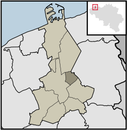
| Municipality | Bruges |
| Area | |
| • Total | 4.17 km2 (1.61 sq mi) |
| Population (2007) | |
| • Total | 3,164 |
| • Density | 759/km2 (1,970/sq mi) |
| Source: NIS | |
| Postal code | 8000 |
Koolkerke is suburb of Bruges in the province of West Flanders in Belgium.
Its name derives from Kool, a short version of the name Nicolas, hence from the church of St Nicholas. The church in Koolkerke was named by the settlement's founder, Nicolaas Gaillaerd.[1]
Other local attractions include the old windmill Ter Panne,[2] and the Groene Poort castle, Dudzeelse steenweg 460 (now called Château Rougesse).[3]