Konradsreuth
| Konradsreuth | ||
|---|---|---|
| ||
 Konradsreuth | ||
Location of Konradsreuth within Hof district 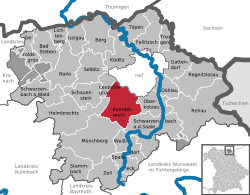 | ||
| Coordinates: 50°16′N 11°50′E / 50.267°N 11.833°ECoordinates: 50°16′N 11°50′E / 50.267°N 11.833°E | ||
| Country | Germany | |
| State | Bavaria | |
| Admin. region | Oberfranken | |
| District | Hof | |
| Government | ||
| • Mayor | Matthias Döhla (SPD) | |
| Area | ||
| • Total | 43.32 km2 (16.73 sq mi) | |
| Population (2013-12-31)[1] | ||
| • Total | 3,241 | |
| • Density | 75/km2 (190/sq mi) | |
| Time zone | CET/CEST (UTC+1/+2) | |
| Postal codes | 95176 | |
| Dialling codes | 09292 | |
| Vehicle registration | HO | |
| Website | www.konradsreuth.de | |

Konradsreuth is a municipality in Upper Franconia in the district of Hof in Bavaria in Germany.
Geography
The districts
With the local government reorganization in 1972, the following villages were merged into Konradsreuth municipality:
| Ahornberg | Berg | Birkenhof | Brand | Eckardsreuth | Engel |
| Frauenhof | Föhrenreuth | Glänzlamühle | Gläsel | Gottschalk | Hollareuth |
| Jägerhaus | Klausenhof | Konradsreuth | Lerchenberg | Martinsreuth | Maschinenhaus (Waldlust) |
| Modlitz | Neudörflein | Oberpferdt | Pretschenreuth | Reuthlas | Ringlasmühle |
| Schallershof | Schallersreuth | Schwarzenfurth | Schödelshöhe | Silberbach | Steinmühle |
| Stiftsgrün | Unterpferdt | Walburgisreuth | Weißlenreuth | Wendlershof | Wölbersbach |
References
- ↑ "Fortschreibung des Bevölkerungsstandes". Bayerisches Landesamt für Statistik und Datenverarbeitung (in German). 31 December 2013.