Komagane, Nagano
| Komagane 駒ヶ根市 | ||
|---|---|---|
| City | ||
| ||
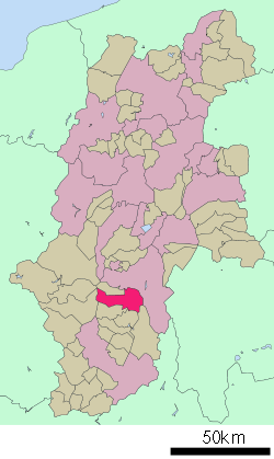 Location of Komagane in Nagano Prefecture | ||
 Komagane Location in Japan | ||
| Coordinates: 35°44′N 137°56′E / 35.733°N 137.933°ECoordinates: 35°44′N 137°56′E / 35.733°N 137.933°E | ||
| Country | Japan | |
| Region | Chūbu (Kōshin'etsu) | |
| Prefecture | Nagano Prefecture | |
| Area | ||
| • Total | 165.92 km2 (64.06 sq mi) | |
| Population (2003) | ||
| • Total | 34,409 | |
| • Density | 210/km2 (540/sq mi) | |
| Time zone | Japan Standard Time (UTC+9) | |
| Website | City of Komagane | |

Komagane (駒ヶ根市 Komagane-shi) is a city located in Nagano Prefecture, Japan.
As of 2003, the city has an estimated population of 34,409 and a population density of 207.38 persons per km². The total area is 165.92 km².
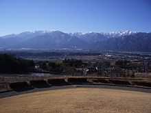
The city was founded on July 1, 1954. Situated at the 220km marker on the southern (Nagoya) branch of the Chūō Expressway, the city lies in a north-south running valley between the Central and Southern Alps. Despite relatively poor communication infrastructure (there is no Shinkansen link and the existing railway is a single track local line), the city derives a large proportion of its overall income from tourism. The Silk Museum is situated to the east of the city, while on the western side of town the Komagatake Ropeway (gondola) ascends Mount Komagatake in the Central Alps. The city has several popular tourist hotels (including one on the mountain which is only accessible via the ropeway), a youth hostel, onsen and a ski resort. It is also host to the Nagano prefectural college of nursing.
External links
![]() Media related to Komagane, Nagano at Wikimedia Commons
Media related to Komagane, Nagano at Wikimedia Commons
- Komagane City official website (Japanese)
| ||||||||||||||