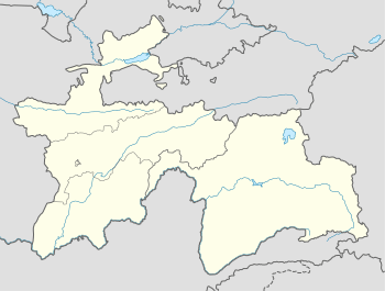
Kolkhozobod
| Kolkhozobod Колхозобод | |
|---|---|
 Kolkhozobod Location in Tajikistan | |
| Coordinates: 37°35′22″N 68°39′39″E / 37.58944°N 68.66083°E | |
| Country |
|
| Province | Khatlon |
| District | Rumi |
| Elevation[1] | 1,280 m (4,200 ft) |
| Population (2008) | |
| • Total | 14,900 |
| Time zone | UTC+5 |
Kolkhozobod (Tajik: Колхозoбoд), also Kolkhozabad (Russian transliteration), is a location in Tajikistan. It is the administrative capital of Rumi District (Kolkhozobod district until June 2007) in the south-west of Khatlon Province.
The population of Kolkhozobod in 2007 is estimated at 14,700.[2]
Historical names
The settlement was called Tugalang between 1882–1934 and Kaganovichabad between 1934-1957. The name Kolkhozabad (Russian version) or Kolkhozobod (Tajik version) was in use until 1991, when the town was renamed imeni Isoeva,[3] literally "a settlement named after Sirodjiddin Isoev", who had headed the district for more than 28 years during the Soviet era and had been awarded a Hero of Socialist Labor. The name Kolkhozobod has been subsequently restored and the district capital is currently listed as Kolkhozobod (or Kolkhozabad) in official publications[2] and on all recent maps.[4][5][6]
A location with the same name (Kolkhozabad) exists also in Gorno-Badakhshan Autonomous Province, in the eastern part of Tajikistan.[7] It lies north-east of Khorugh on the Pamir Highway 37°36′N 71°46′E / 37.600°N 71.767°E.
Geography
Climate
The Köppen Climate Classification sub-type for Kolkhozobod is "Csa" or a Mediterran Climate. The average annual temperature is 16.8°C (62.2°F). The warmest month is July with an average temperature of 29.2°C (84.6°F) and the coolest month is January with an average temperature of 3.1°C (37.6°F). The average annual precipitation is 279.4mm (11") and has an average of 70 days with precipitation. The wettest month is March with an average of 67.1mm (2.6") of precipitation and the driest month is August with an average of 0.1mm of precipitation.[1]
| Climate data for Kolkhozobod | |||||||||||||
|---|---|---|---|---|---|---|---|---|---|---|---|---|---|
| Month | Jan | Feb | Mar | Apr | May | Jun | Jul | Aug | Sep | Oct | Nov | Dec | Year |
| Daily mean °C (°F) | 3.1 (37.6) |
5.9 (42.6) |
11.6 (52.9) |
18.0 (64.4) |
23.0 (73.4) |
27.8 (82) |
29.2 (84.6) |
27.0 (80.6) |
22.3 (72.1) |
16.8 (62.2) |
10.7 (51.3) |
5.8 (42.4) |
16.8 (62.2) |
| Average precipitation mm (inches) | 37.9 (1.492) |
42.6 (1.677) |
67.1 (2.642) |
45.5 (1.791) |
24.8 (0.976) |
1.2 (0.047) |
0.5 (0.02) |
0.1 (0.004) |
0.3 (0.012) |
8 (0.31) |
20.1 (0.791) |
31.3 (1.232) |
279.4 (11) |
| Avg. precipitation days (≥ 0.1 mm) | 9.8 | 10.2 | 12.3 | 9.9 | 7.1 | 1.4 | 0.6 | 0.1 | 0.3 | 3.4 | 5.7 | 9.2 | 70 |
| Average relative humidity (%) | 74.0 | 70.7 | 67.8 | 63.4 | 51.8 | 35.9 | 33.8 | 35.0 | 37.9 | 48.3 | 60.8 | 71.3 | 54.2 |
| Source: "The Climate of Kolkhozobod". Weatherbase. Retrieved 2 August 2014. | |||||||||||||
References
- ↑ 1.0 1.1 "Climate of Kolkhozobod". Weatherbase.com. Retrieved 2 August 2014.
- ↑ 2.0 2.1 Population of the Republic of Tajikistan as of 1 January 2008, State Committee of Statistics, Dushanbe, 2008 (Russian)
- ↑ District capital names (Russian)
- ↑ Republic of Tajikistan, map showing administrative division as of January 1, 2004, "Tojikkoinot" Cartographic Press, Dushanbe, 2004 (Russian)
- ↑ Viloyati Khatlon, map showing administrative division of Khatlon Province as of January 1, 2006, "Map Factory" Cartographic Press, Dushanbe, 2006 (Russian)
- ↑ Republic of Tajikistan, map showing administrative division as of January 1, 2007, "Map Factory" Cartographic Press, Dushanbe, 2007 (English)
- ↑ The curious story of the name Kolkhozabad in Tajikistan's Pamir region (Russian)
External links
Coordinates: 37°35′22″N 68°39′39″E / 37.58944°N 68.66083°E
| ||||||||||||||||
