Kokshetau
| Kokshetau Көкшетау | ||
|---|---|---|
| City | ||
 | ||
| ||
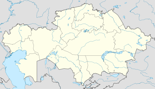
 Kokshetau Location in Kazakhstan | ||
| Coordinates: 53°17′N 69°23′E / 53.283°N 69.383°ECoordinates: 53°17′N 69°23′E / 53.283°N 69.383°E | ||
| Country | Kazakhstan | |
| Region | Akmola | |
| City status | 1862 | |
| Government | ||
| • Akim (mayor) | Zharkyn Zhumagulov | |
| Area | ||
| • Total | 400 km2 (200 sq mi) | |
| Population (2013-07-01)[1] | ||
| • Total | 153,057 | |
| • Density | 380/km2 (990/sq mi) | |
| Time zone | UTC +6 (UTC+6) | |
| Postal code | 020000 | |
| Area code(s) | +7 7162 | |
| Vehicle registration | C, 03 | |
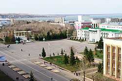
Kokshetau (Kazakh: Көкшетау / Kökşetaw), formerly known as Kokchetav (Russian: Кокчетав, until 1993) is the administrative center of Akmola Region, northern Kazakhstan. Population: 135,106 (2009 Census results);[2]123,389 (1999 Census results).[2]
Geography
Astana, the new capital of Kazakhstan, is distant 299 km south-eastwards. Kokshetau is well known for its nature and tourist sites, such as Burabay (Borovoe) Resort, among others. Kokshetau was settled on a lake, called Kopa (Russian: Копа).
Climate
Kokshetau has a humid continental climate (Köppen climate classification Dfb) with long, cold winters and warm summers. The average temperature in January is −15.3 °C (4.5 °F). In July the temperature averages 20.2 °C (68.4 °F). Yearly precipitation amounts to 313 mm (12.3 in).
| Climate data for Kokshetau | |||||||||||||
|---|---|---|---|---|---|---|---|---|---|---|---|---|---|
| Month | Jan | Feb | Mar | Apr | May | Jun | Jul | Aug | Sep | Oct | Nov | Dec | Year |
| Daily mean °C (°F) | −15.3 (4.5) |
−15.1 (4.8) |
−7.4 (18.7) |
4.0 (39.2) |
12.2 (54) |
18.4 (65.1) |
20.2 (68.4) |
16.8 (62.2) |
11.3 (52.3) |
2.5 (36.5) |
−6.1 (21) |
−11.8 (10.8) |
2.47 (36.46) |
| Average precipitation mm (inches) | 12.8 (0.504) |
11.3 (0.445) |
10.5 (0.413) |
17.9 (0.705) |
32.7 (1.287) |
40.2 (1.583) |
68.5 (2.697) |
43.6 (1.717) |
24.8 (0.976) |
22.8 (0.898) |
15.7 (0.618) |
11.7 (0.461) |
312.5 (12.304) |
| Avg. rainy days | 3.7 | 3.4 | 3.0 | 4.2 | 6.5 | 6.5 | 8.5 | 7.3 | 5.5 | 6.2 | 4.3 | 3.3 | 62.4 |
| Mean monthly sunshine hours | 89.0 | 127.0 | 196.0 | 227.0 | 277.0 | 306.0 | 313.0 | 250.0 | 190.0 | 118.0 | 88.0 | 75.0 | 2,256 |
| Source: NOAA (1961-1990) [3] | |||||||||||||
History
The town was founded in 1824 as a fortress, named for the Kokshetau hill it was built on; the name is Kazakh for "blue mountain".[4] In 1868 it became an uyezd center. In 1997 Kokshetau region was abolished. After a change in administrative structure of Akmola and North Kazakhstan region Kokshetau has become as a regional center of Akmola region.
During the late 1930s, as a result of the Polish operation of the NKVD - USSR citizens of Polish nationality, related national operations, also against Kazakhstan SSR Germans, since 1939 many residents of the Poland's kresy wschodnie were forcibly settled in this region, and Kokchetav became the center of the Polish diaspora in Kazakhstan.[5] On March 16, 1944, the Kokchetav Oblast was created, with Kokchetav as its administrative center.
Industry
There are urban light industries such as food production. The region produces low grades of wheat and other cultures. There is a gold mining operation north of the city.
Kokshetau Mineral Waters company produces drinks such as still, sparkling water of the high-quality. It also produces alcohol beverages. The most known brands are: still and sparkling water "Свежесть", sparkling water "Кулагер" and still water "Туран", vodka brands "Хаома", "Дастур". Company's web-site: Kokshetau Mineral Waters
Kokshetau is the termination of world's only operational powerline with a voltage greater than 1000 kV, the Powerline Ekibastuz-Kokshetau.
Transport
Kokshetau has one airport with flights to Almaty and Petropavl. The city is connected by railroad with southern Kazakhstan and Russia. Road transport to Astana include buses and shared taxis. The trip to Astana takes approximately 3 hours.
Sister cities
 Waukesha (USA) since 1989
References
- ↑ http://www.akmola.stat.kz/oblasti/koksh.htm
- ↑ 2.0 2.1 "Население Республики Казахстан" (in Russian). Департамент социальной и демографической статистики. Retrieved 8 December 2013.
- ↑ "Kokshetay Climate Normals 1961-1990". National Oceanic and Atmospheric Administration. Retrieved January 10, 2013.
- ↑ E.M. Pospelov, Geograficheskie nazvaniya mira (Moscow, 1998), p. 208.
- ↑ Kate Brown, A Biography of No Place: From Ethnic Borderland to Soviet Heartland (Harvard University Press, 2004: ISBN 0-674-01168-6), pp. 173-74.
External links
| Wikimedia Commons has media related to Kokshetau. |
 Kokshetau travel guide from Wikivoyage
Photos and videos
- 360° QTVR fullscreen panoramas of the Kokshetau
| |||||||||||||||||
| ||||||||||||


